- Alla avslutade föremål
- /
- Stockholms Auktionsverk Magasin 5
- /
- Böcker, Kartor & Handskrifter
- /
- Kartor
- /
MAP OF TURKEY AND CYPRUS, Blaeu ca 1634.
Auktionen är avslutad, men kanske gillar du följande föremål?

Bilder
Beskrivning
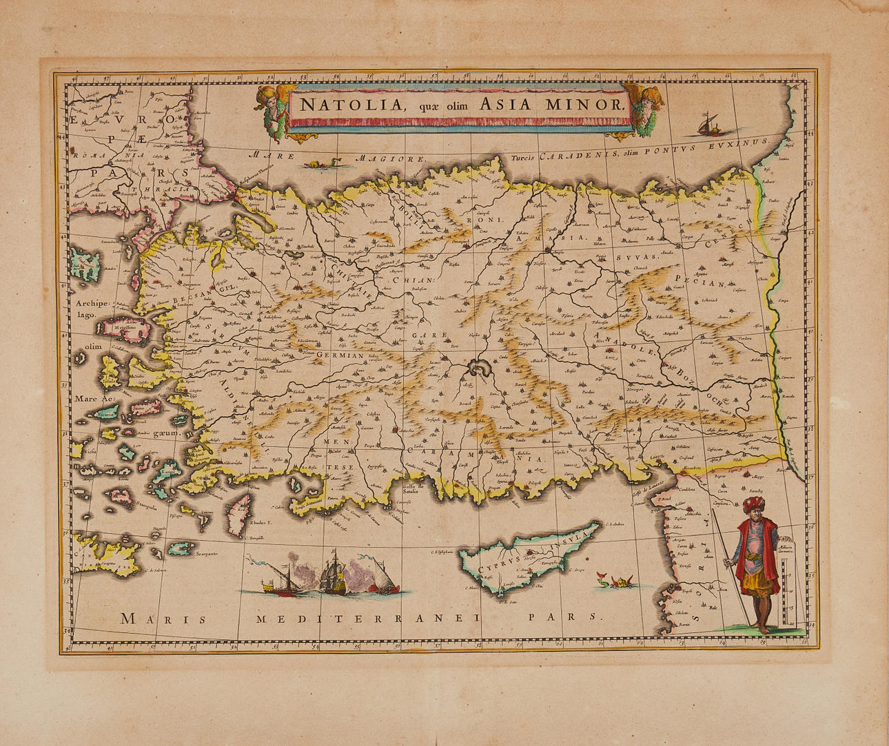
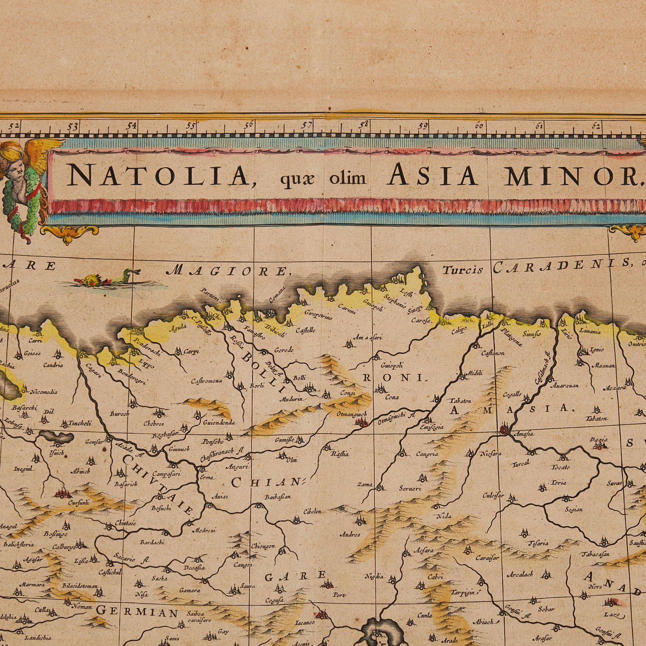
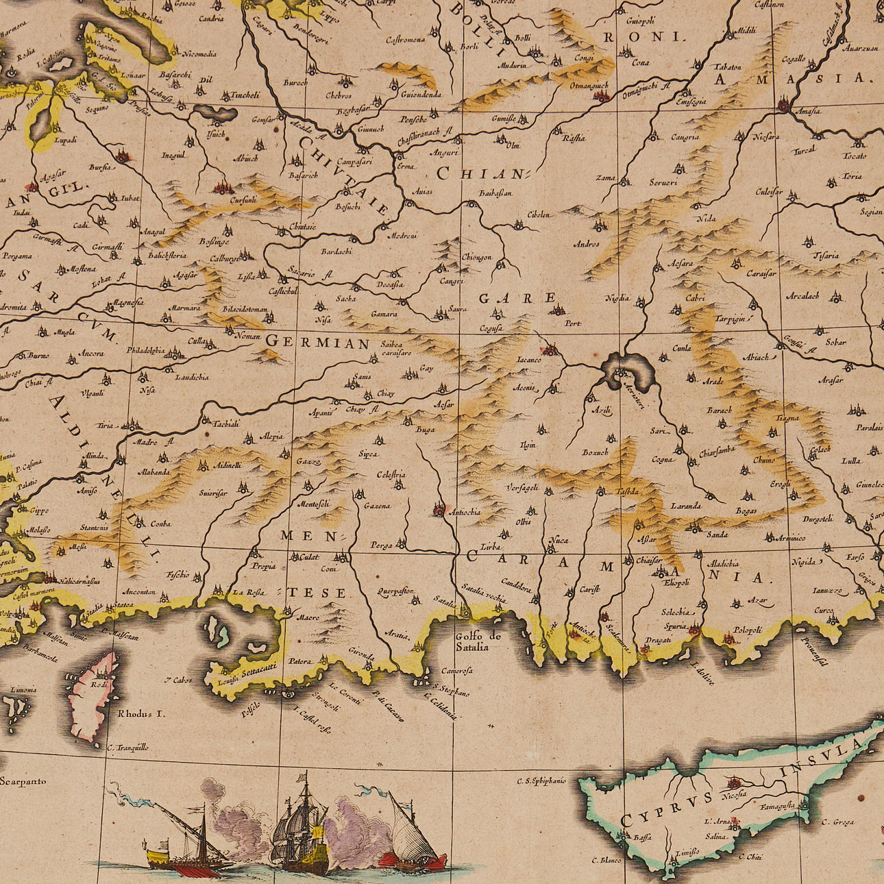
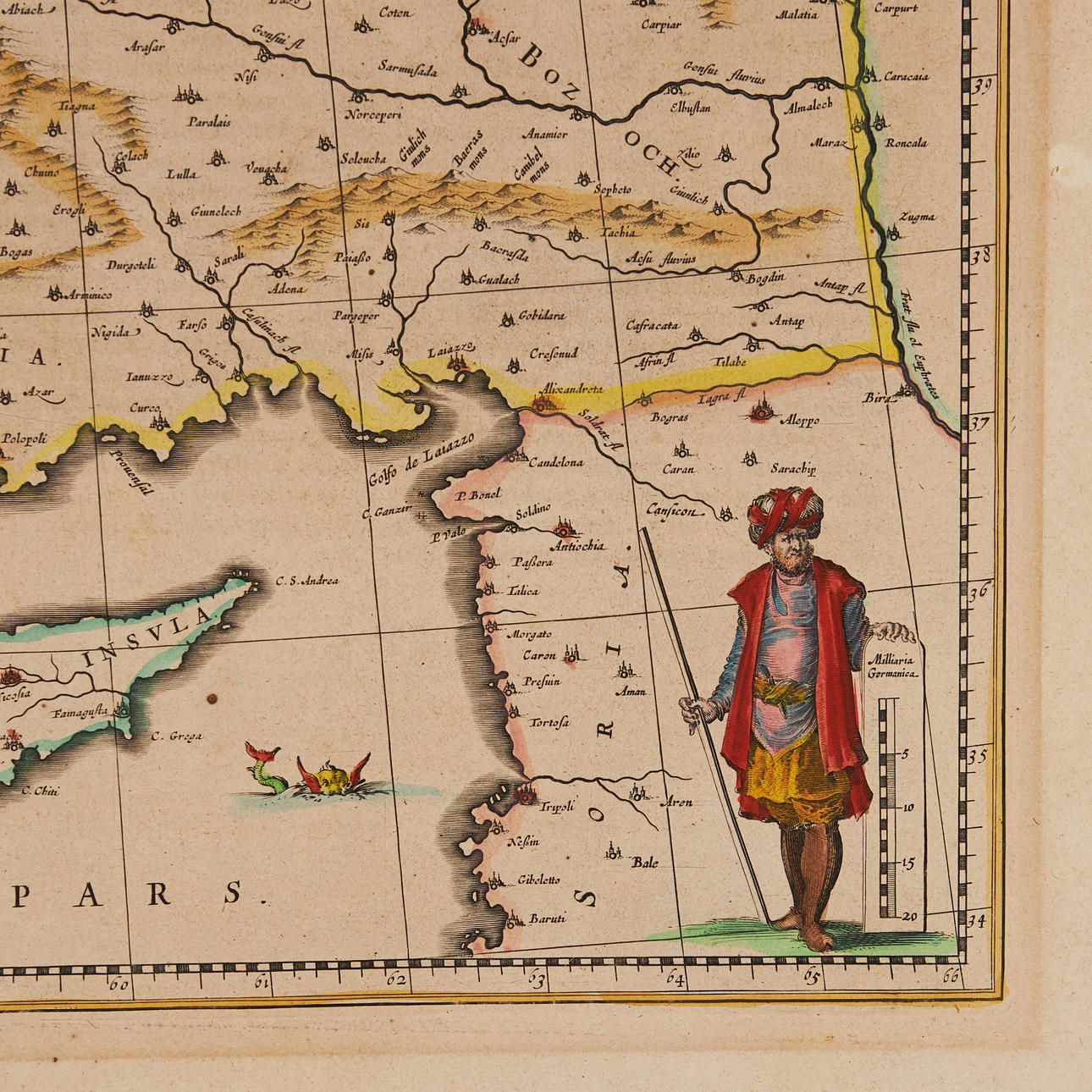
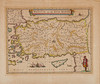
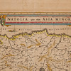
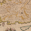
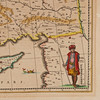
BLAEU, Willem Janszoon. Natolia, quae olim Asia Minor [with Cyprus]. Amsterdam ca 1634..
Hand-coloured engraved map with cartouche at the top, sea beast, sailing ships (battle scene) and a man standing beside the scale. Ca 385 x 500 mm. Latin text on verso, page number 14.
The maps shows Turkey, Cyprus and the islands in the Aegean. Also large cities, like Constantinople (Istanbul) and Smryna (Izmir).
From Blaeu's Atlas Novus.
Konditionsrapport
Centrefold as issued. Some browning to margins. Small spot.
Tema
Har du något liknande att sälja? Gör en kostnadsfri värdering!
Beskrivning
BLAEU, Willem Janszoon. Natolia, quae olim Asia Minor [with Cyprus]. Amsterdam ca 1634..
Hand-coloured engraved map with cartouche at the top, sea beast, sailing ships (battle scene) and a man standing beside the scale. Ca 385 x 500 mm. Latin text on verso, page number 14.
The maps shows Turkey, Cyprus and the islands in the Aegean. Also large cities, like Constantinople (Istanbul) and Smryna (Izmir).
From Blaeu's Atlas Novus.
Konditionsrapport
Centrefold as issued. Some browning to margins. Small spot.
Tema
Har du något liknande att sälja? Gör en kostnadsfri värdering!