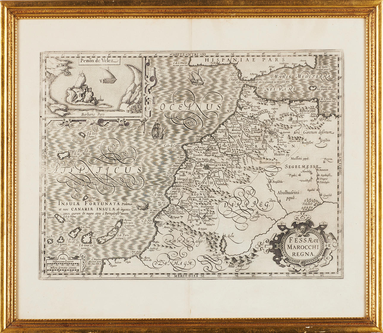
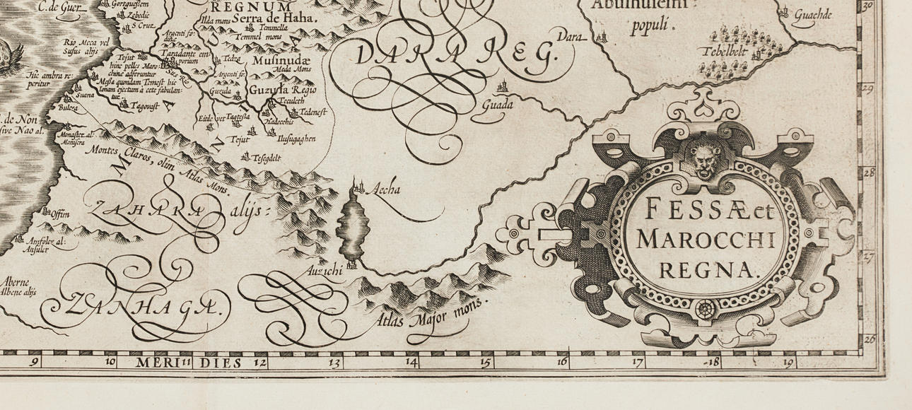
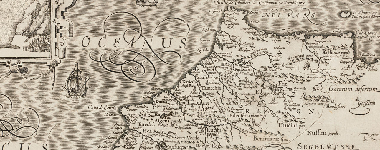
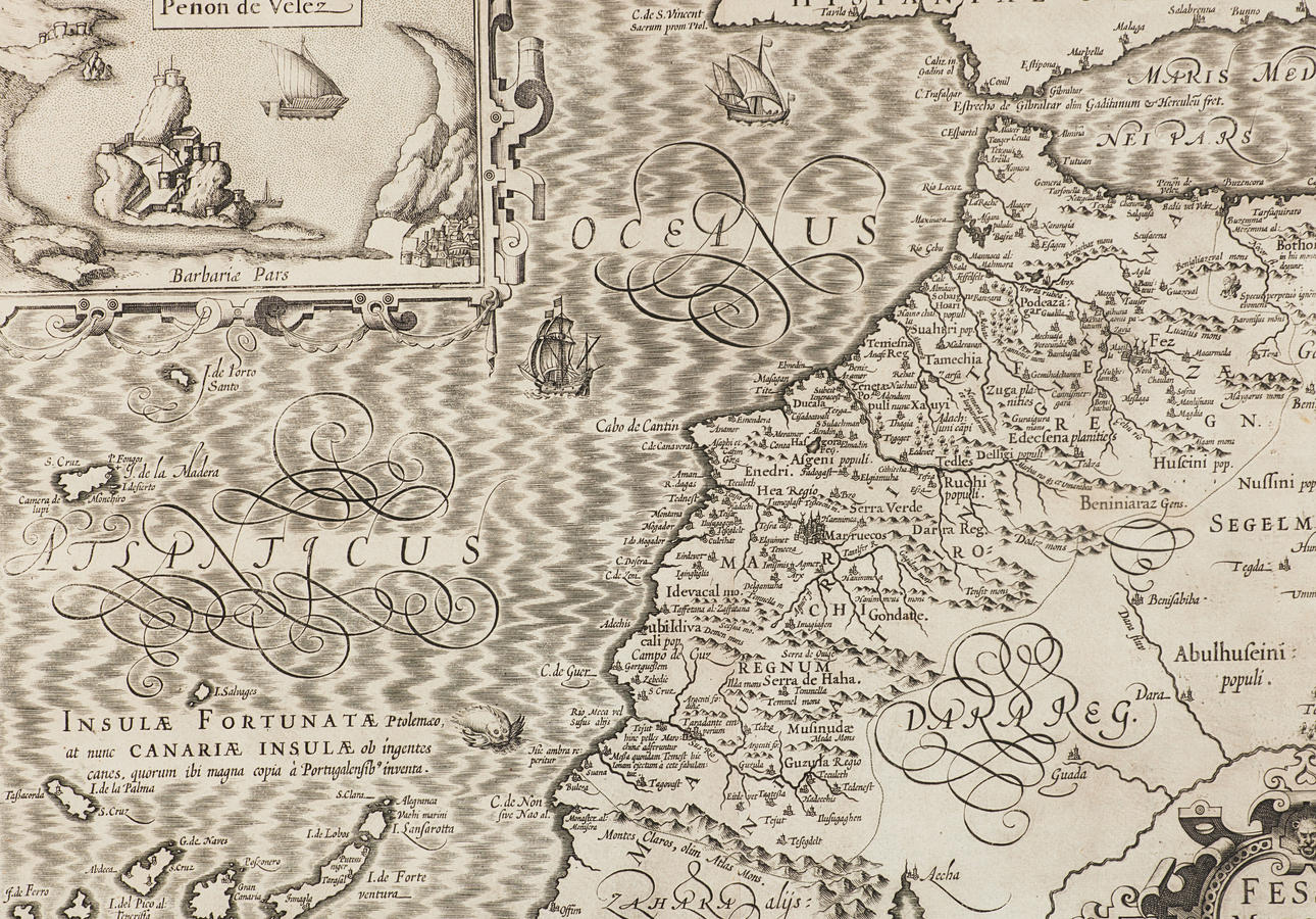
Map of Morocco by Mercator 1620.
Auktionen är avslutad, men kanske gillar du följande föremål?

Bilder
Beskrivning
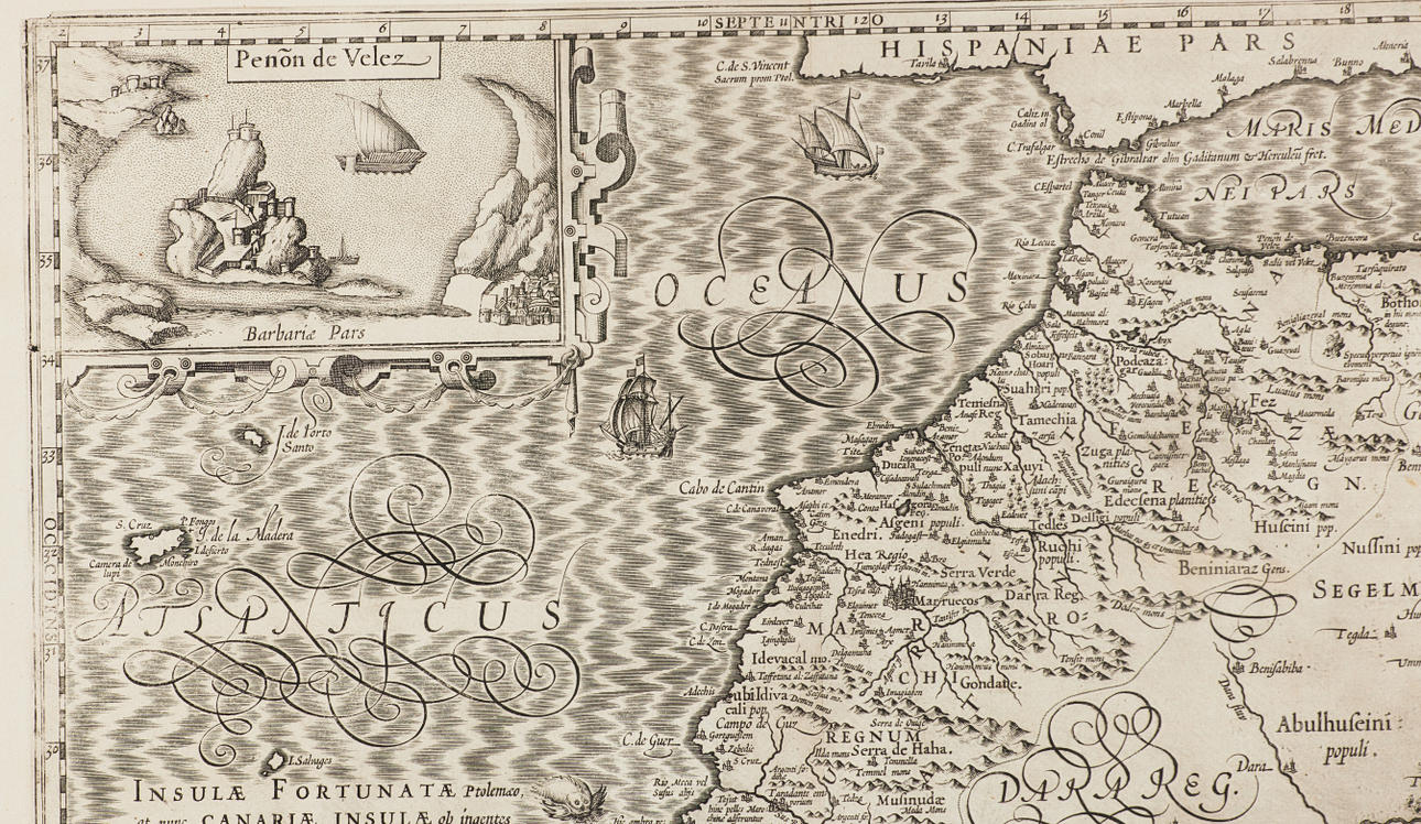
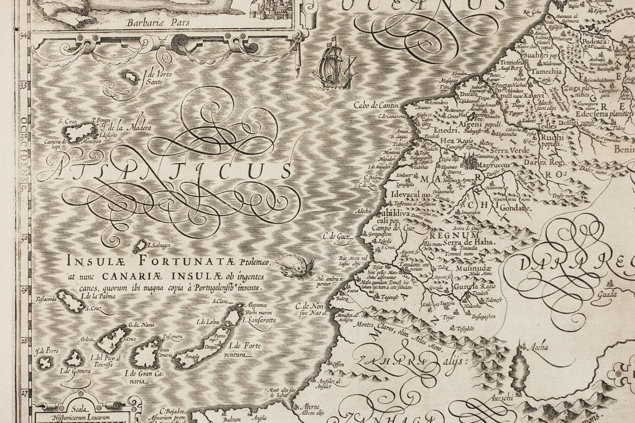
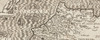
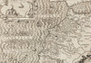
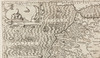
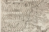
MAP OF MOROCCO - NORTHWEST AFRICA. MECATOR - HONDIUS. Fessae et Marocchi Regna. Amsterdam c. 1620.
Engraved map with embellished title cartouche and inset map of Penon de Velez, sailing ships and sea beasts. C. 355x480 mm. Framed.
This is one of the most decorative maps of the important kingdoms of Fez and Morocco. A large inset titled Penon de Velez shows the Spanish fort off the Barbary Coast. The map includes the Canary Islands and Madeira.
It s the first of two maps of the region that were made for Mercator's Atlas.
Konditionsrapport
Centrefold as issued, some slight creases.
Tema
Har du något liknande att sälja? Gör en kostnadsfri värdering!
Beskrivning
MAP OF MOROCCO - NORTHWEST AFRICA. MECATOR - HONDIUS. Fessae et Marocchi Regna. Amsterdam c. 1620.
Engraved map with embellished title cartouche and inset map of Penon de Velez, sailing ships and sea beasts. C. 355x480 mm. Framed.
This is one of the most decorative maps of the important kingdoms of Fez and Morocco. A large inset titled Penon de Velez shows the Spanish fort off the Barbary Coast. The map includes the Canary Islands and Madeira.
It s the first of two maps of the region that were made for Mercator's Atlas.
Konditionsrapport
Centrefold as issued, some slight creases.
Tema
Har du något liknande att sälja? Gör en kostnadsfri värdering!