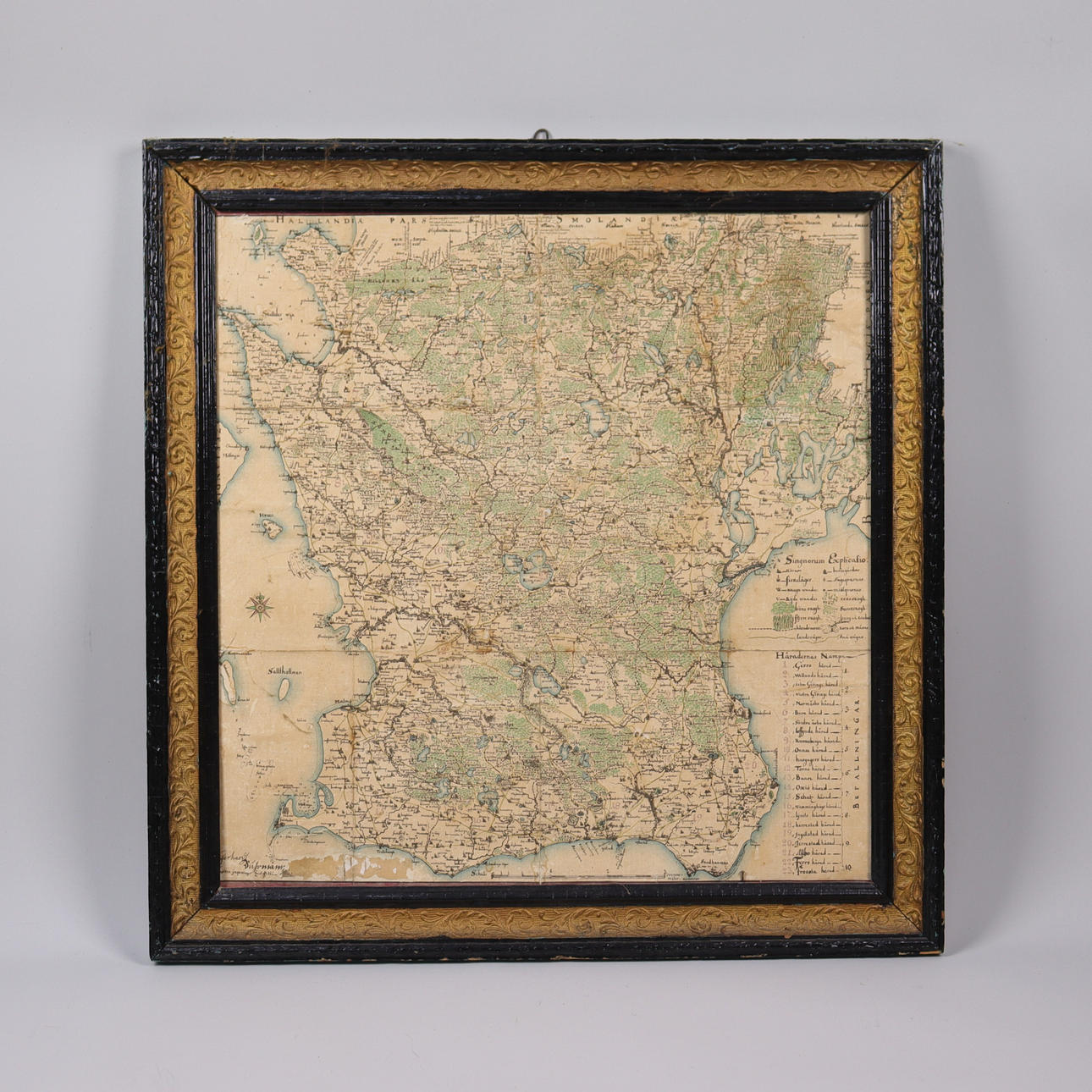
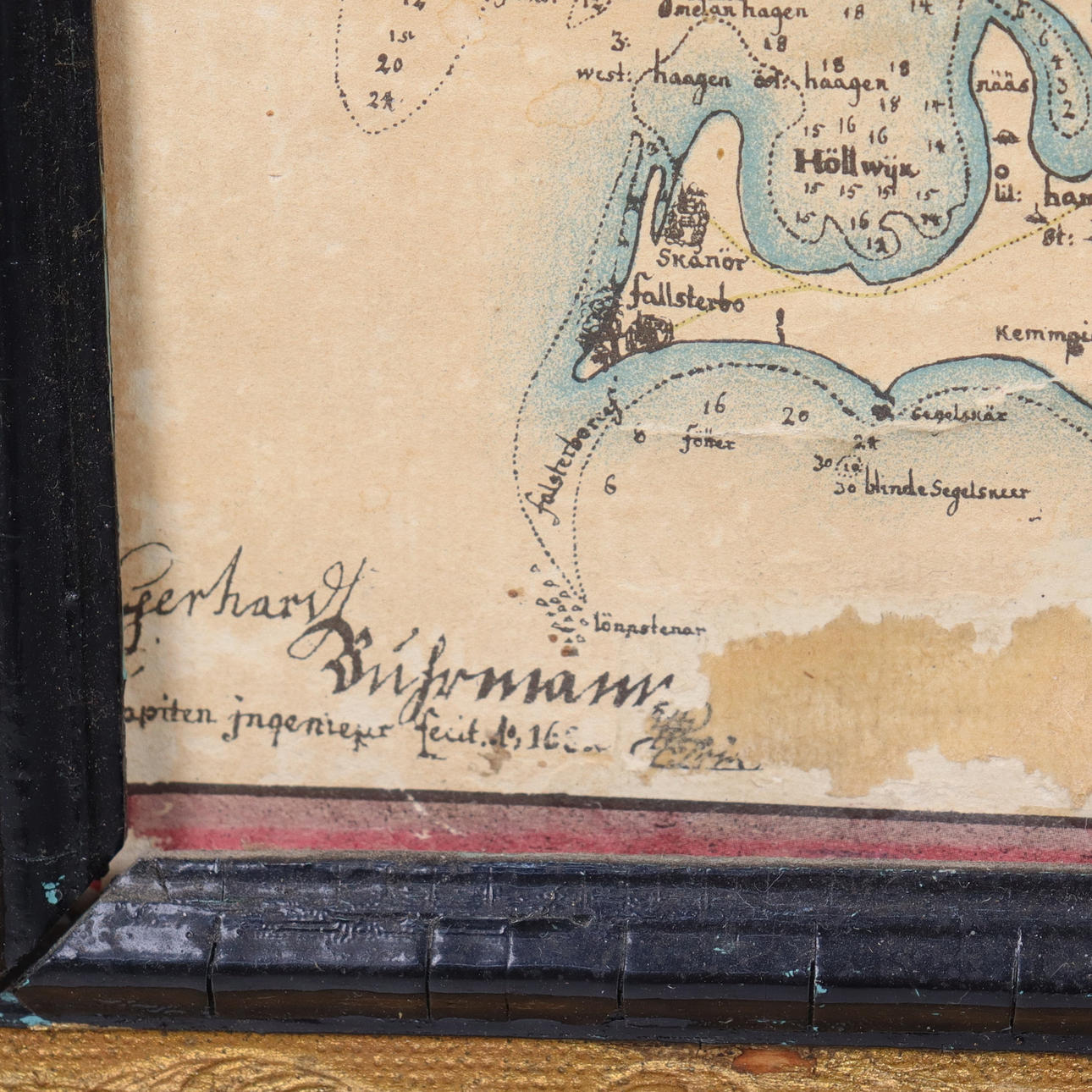
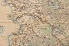
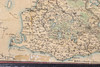
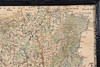
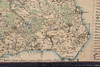
GERHARD VON BURMAN. map, Skåne 1684, older facsimile.

Images


Description
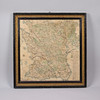
Frame dimensions 55x56 cm.
About:
Gerhard von Buhrman (1653 — died 1701) was a Swedish military and cartographer.
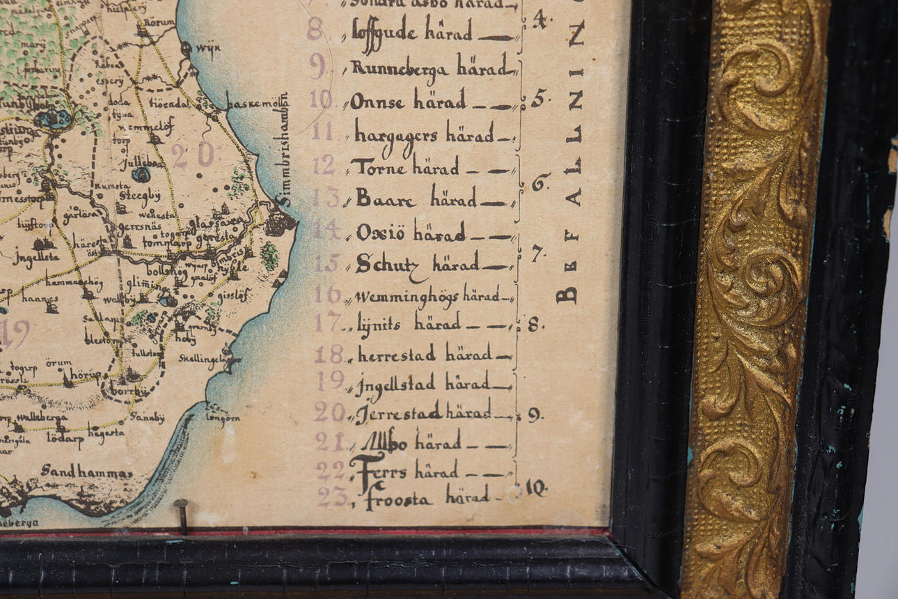
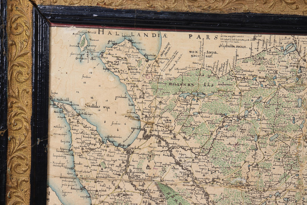
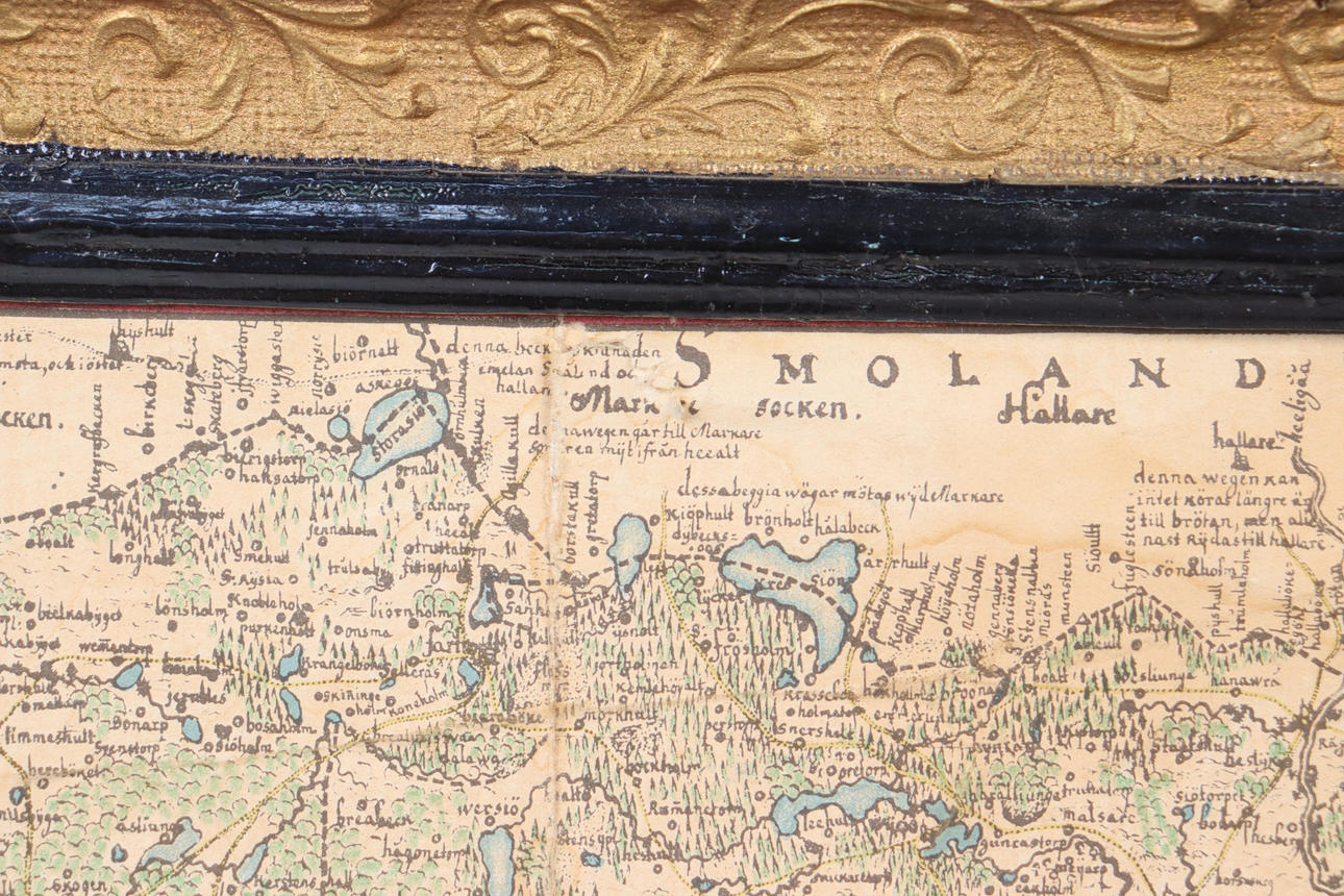
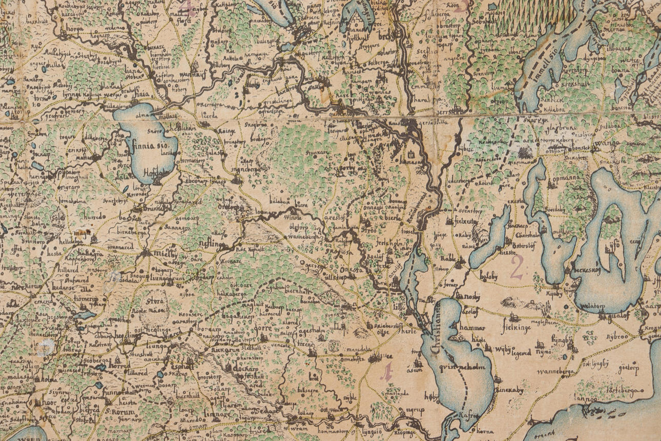
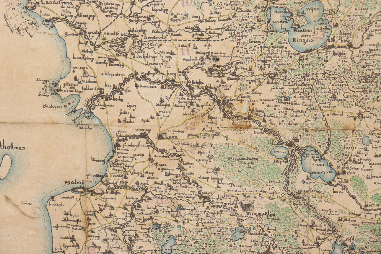
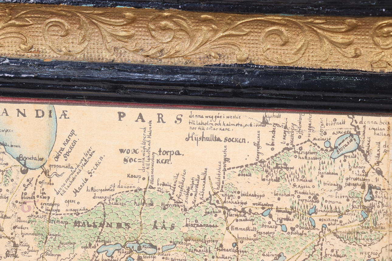
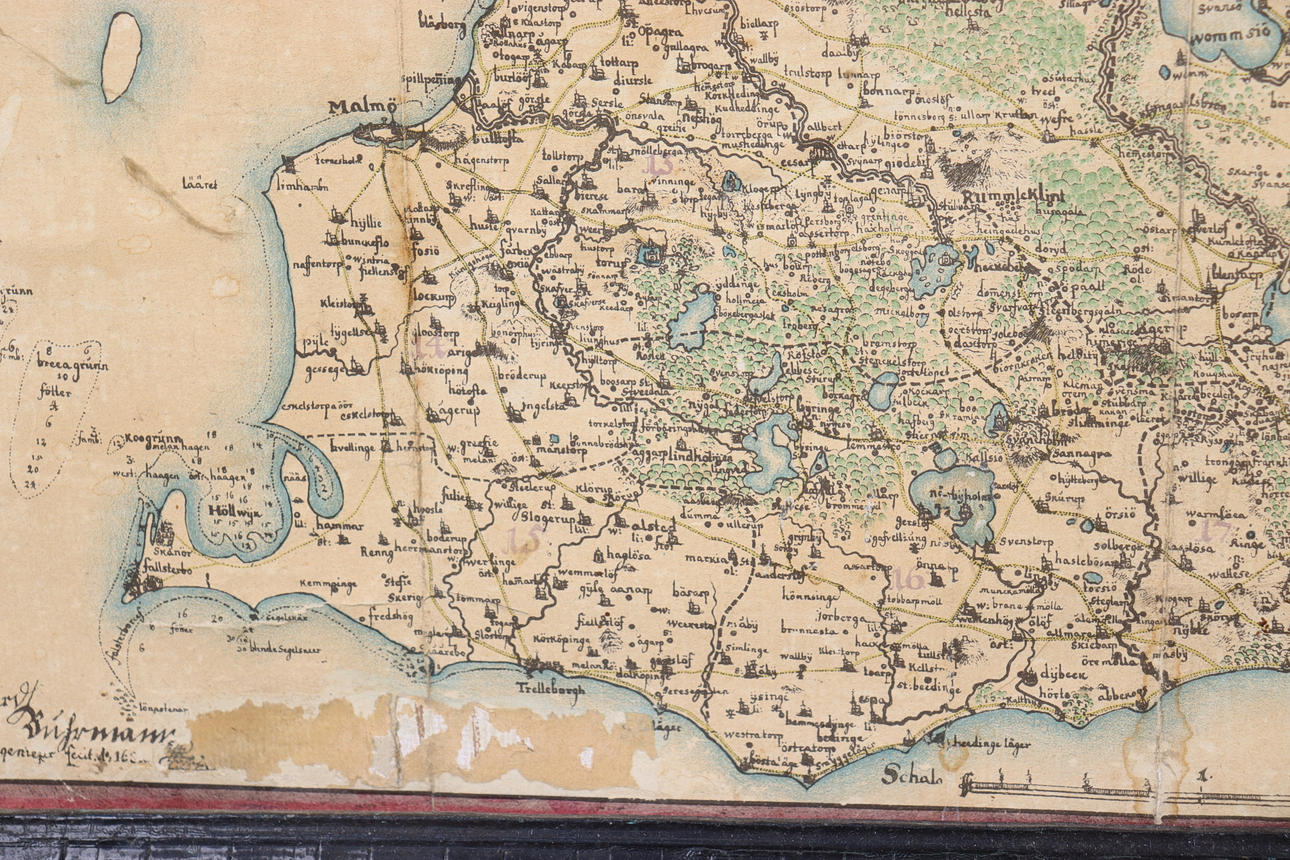
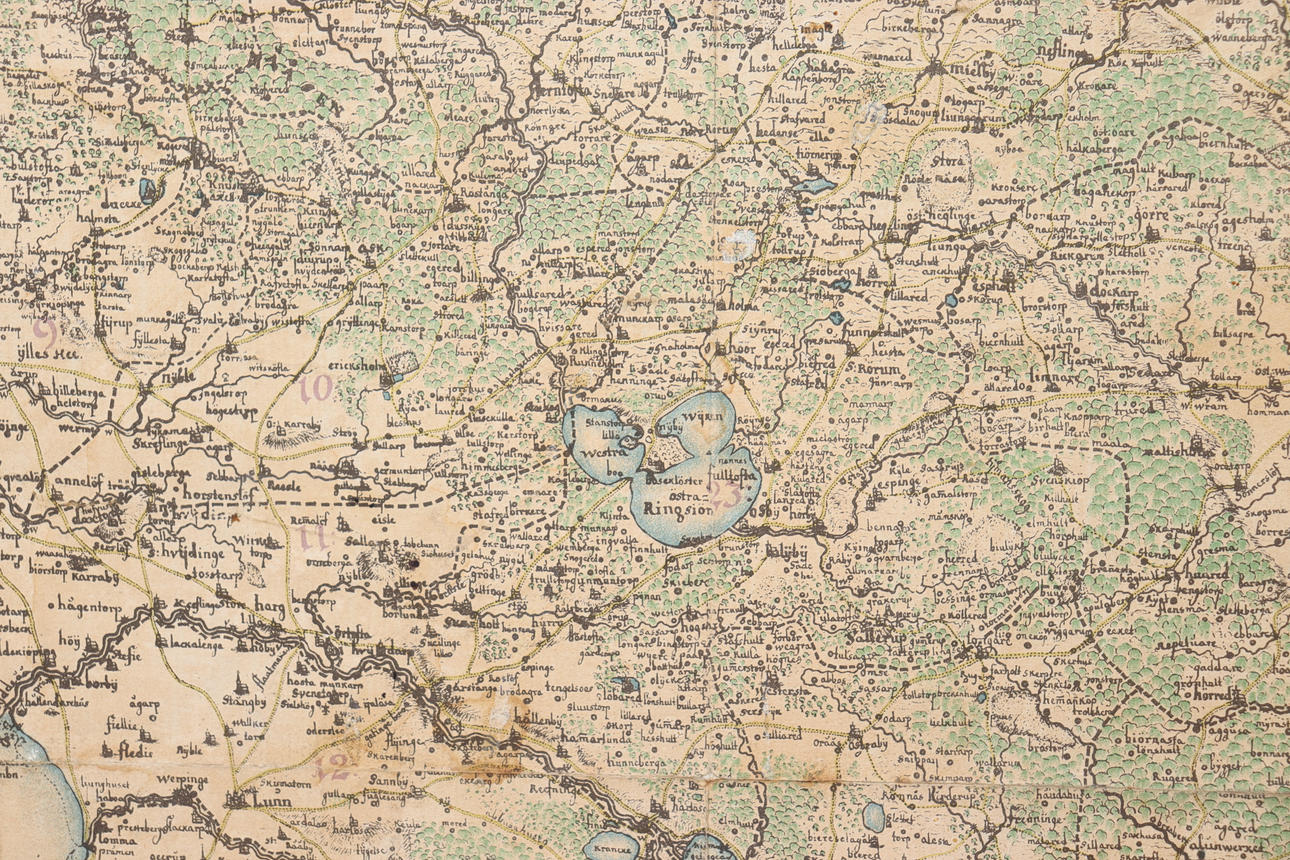
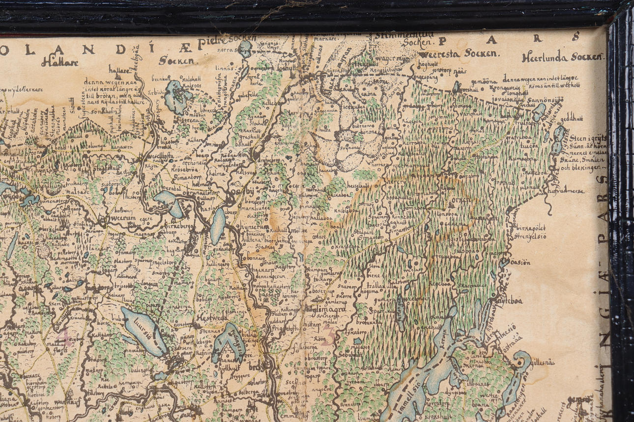
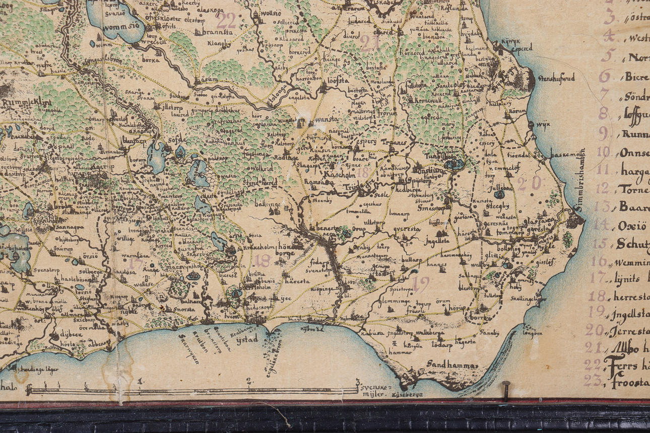
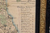
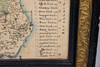
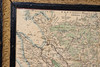
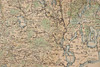
Gerhard von Buhrman's map of Skåne from 1684.
von Buhrman was in 1672—1674 in foreign service and subsequently participated in the entire Scanian War as a fortification officer. He subsequently served as Quartermaster-Lieutenant General in Skåne and contributed meritoriously to the fortification of Malmö. He visited with a state scholarship the fields of Flanders in 1693—1695. In 1695 he was promoted to lieutenant-colonel.
He is best known today as a cartographer. The maps drawn by Gerhard Buhrman were intended partly for the war powers, and partly to form the basis for the tax registers and land books. In the spring of 1681, Buhrman was commissioned to survey Jämtland and Värmland, and in the autumn of the same year Skåne.
von Buhrman's 1684 map of Skåne is by far in terms of accuracy and elegance. The maps stand up well in their correctness and are a result of his participation in the Scanian War, in which Buhrman participated as a quartermaster-lieutenant general.
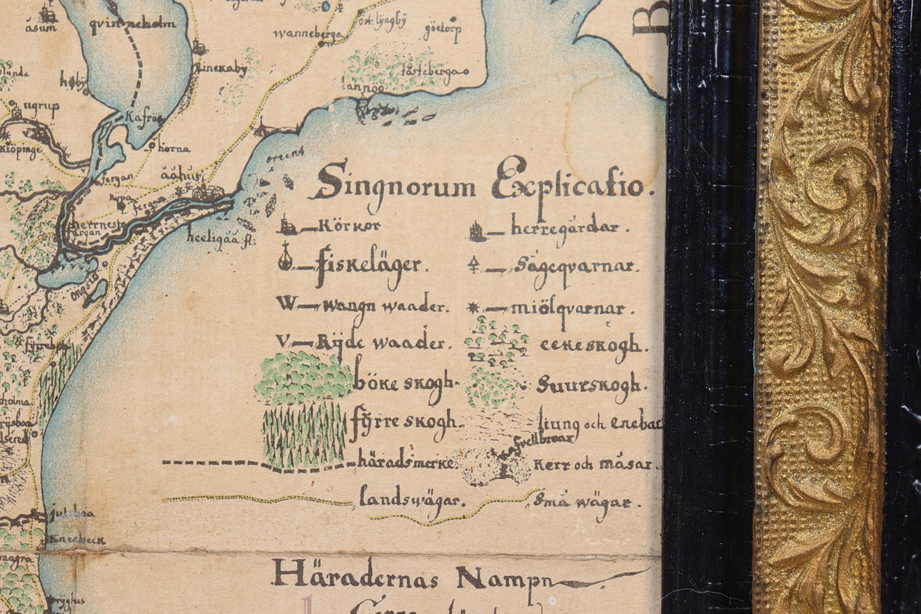
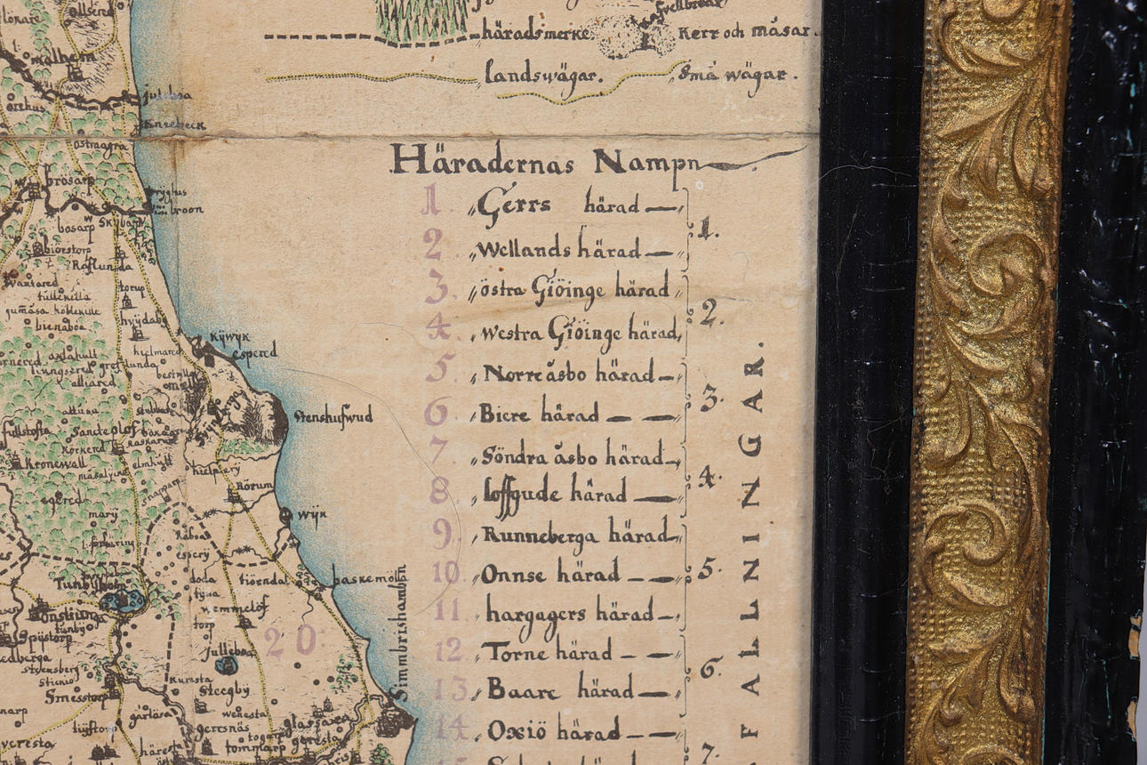
In 1680 von Buhrman travelled around Skåne and made drawings of about fifty castles and lordships. His drawings were published in 1756 by Abraham Fischer in the work Prospecter of several remarkable buildings, farms and manor houses in Skåne. They are presented in the form of copper engravings executed by Carl Bergquist. Around 1680 he was commissioned to make a map of Skåne. The family then moved to Önnestad parish and from there von Buhrman travelled out and measured localities and distances. von Buhrman designed various types of forests, country roads, small roads and paths, churches, fishing villages, paddocks and bridges, mills, manors, villages and towns, and hearths. Most of the significance came along and much of what we see today can be found on his map. The roads in Skåne at the end of the 17th century have largely remained to our days.
Condition
Usage and age-related wear. Damage, stains and creases.
Resale right
Description
Frame dimensions 55x56 cm.
About:
Gerhard von Buhrman (1653 — died 1701) was a Swedish military and cartographer.
Gerhard von Buhrman's map of Skåne from 1684.
von Buhrman was in 1672—1674 in foreign service and subsequently participated in the entire Scanian War as a fortification officer. He subsequently served as Quartermaster-Lieutenant General in Skåne and contributed meritoriously to the fortification of Malmö. He visited with a state scholarship the fields of Flanders in 1693—1695. In 1695 he was promoted to lieutenant-colonel.
He is best known today as a cartographer. The maps drawn by Gerhard Buhrman were intended partly for the war powers, and partly to form the basis for the tax registers and land books. In the spring of 1681, Buhrman was commissioned to survey Jämtland and Värmland, and in the autumn of the same year Skåne.
von Buhrman's 1684 map of Skåne is by far in terms of accuracy and elegance. The maps stand up well in their correctness and are a result of his participation in the Scanian War, in which Buhrman participated as a quartermaster-lieutenant general.
In 1680 von Buhrman travelled around Skåne and made drawings of about fifty castles and lordships. His drawings were published in 1756 by Abraham Fischer in the work Prospecter of several remarkable buildings, farms and manor houses in Skåne. They are presented in the form of copper engravings executed by Carl Bergquist. Around 1680 he was commissioned to make a map of Skåne. The family then moved to Önnestad parish and from there von Buhrman travelled out and measured localities and distances. von Buhrman designed various types of forests, country roads, small roads and paths, churches, fishing villages, paddocks and bridges, mills, manors, villages and towns, and hearths. Most of the significance came along and much of what we see today can be found on his map. The roads in Skåne at the end of the 17th century have largely remained to our days.
Condition
Usage and age-related wear. Damage, stains and creases.
Resale right
Payment options for this item
Payment cardsBank transferDelivery
: Provide your locationInfo temporarily unavailableLoading…Provide your location to see transport options and prices.
Oops! Something went wrong.
Please try again in a moment. If it still doesn't work, contact Auctionet support.
Details
- House
- Markus Auktioner
- Address
Lastvägen 3
231 62 Trelleborg
Sweden- Placement
- Teakhylla