ORTELIUS, Valentiae Regni, 1584.
This auction is closed, but maybe you like the following items?

Images


Description
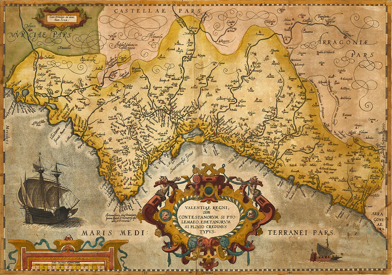
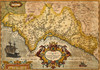
Abraham Ortelius (1527-1598), "Valentiae Regni, olim, Contestanorum Si Ptolemaeo, Edetanorum Si Plinio Credimus Typus", engraved and hand-colored map of the Kingdom of Valencia, 1584, from Ortelius' "Theatrum Orbis Terrarum". Latin edition 1584 (1584L18, 750 copies).
Plate: 35 x 49.8 cm.
Sheet: 42.5 x 54 cm (watermark "Crossed arrows").
LITERATURE: Van den Broecke, Ort 29 (not in Koeman or Meurer).
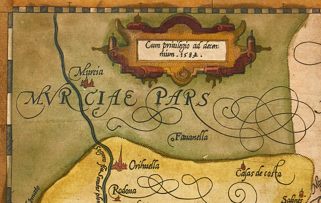
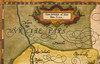
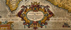
Map of the Kingdom of Valencia with a large title cartouche centrally in the lower part of the image, flanked by ships on either side. In the upper left corner, a small cartouche with the privilege for 10 years, dated 1584. The border with Aragon with clarification regarding the new and old border demarcation ("Limes vetus inter Valentiam et Arragoniam. Limes nouus inter Valentiam et Arragoniam.").
Abraham Ortelius (1527-1598) was born in Antwerp and studied Greek and Latin as well as mathematics. Together with his sisters Anne and Elisabeth, he colored maps, but also dealt in antiquities, coins, books, and maps. His business grew, as did his network of contacts with the scientists and book publishers of the time, which was also facilitated by the many trips he made in Europe.
In 1564, he published his first map, a world map that today has only survived in barely a handful of copies. In 1565, a map of Egypt and the Holy Land, as well as a map of Asia. By 1568, the production of individual maps for his atlas "Theatrum Orbis Terrarum" was in full swing, and the following year, 1569, the atlas was completed. In May 1570, it was offered for sale to interested buyers and was one of the most expensive books ever published. The first edition consisted of 70 maps printed on 53 sheets, and engraved by Frans Hogenberg. It became extremely sought after and about 24 editions were published during Ortelius' lifetime, and thereafter another 10 editions in six different languages until 1612; the atlas also grew in the number of maps and pages as new editions were published. The importance of Ortelius' atlas for the late 16th-century understanding of the world and geographical knowledge cannot be overstated. Today, one often speaks of Ortelius' atlas when referring to "Theatrum Orbis Terrarum"; however, the term atlas itself was only introduced over 20 years later by Mercator, but Ortelius was the one who, in a true sense, created the first modern atlas.
Condition
Discolored. Stains. Tear (approx. 30mm) in the left part of the upper margin. Tear (approx. 75mm) along the lower part of the center fold (in the image).
Theme
Francesco Bacoccoli Collection - The Golden Era of Cartography: Part II
Do you have something similar to sell? Get your items valued free of charge!
Description
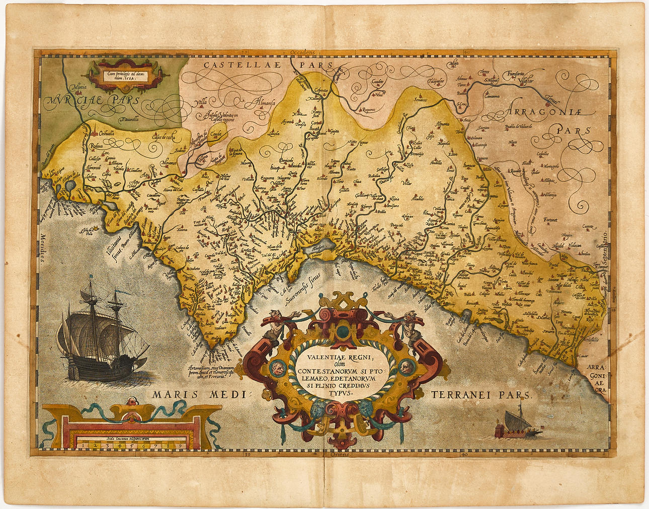
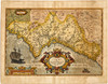
Abraham Ortelius (1527-1598), "Valentiae Regni, olim, Contestanorum Si Ptolemaeo, Edetanorum Si Plinio Credimus Typus", engraved and hand-colored map of the Kingdom of Valencia, 1584, from Ortelius' "Theatrum Orbis Terrarum". Latin edition 1584 (1584L18, 750 copies).
Plate: 35 x 49.8 cm.
Sheet: 42.5 x 54 cm (watermark "Crossed arrows").
LITERATURE: Van den Broecke, Ort 29 (not in Koeman or Meurer).
Map of the Kingdom of Valencia with a large title cartouche centrally in the lower part of the image, flanked by ships on either side. In the upper left corner, a small cartouche with the privilege for 10 years, dated 1584. The border with Aragon with clarification regarding the new and old border demarcation ("Limes vetus inter Valentiam et Arragoniam. Limes nouus inter Valentiam et Arragoniam.").
Abraham Ortelius (1527-1598) was born in Antwerp and studied Greek and Latin as well as mathematics. Together with his sisters Anne and Elisabeth, he colored maps, but also dealt in antiquities, coins, books, and maps. His business grew, as did his network of contacts with the scientists and book publishers of the time, which was also facilitated by the many trips he made in Europe.
In 1564, he published his first map, a world map that today has only survived in barely a handful of copies. In 1565, a map of Egypt and the Holy Land, as well as a map of Asia. By 1568, the production of individual maps for his atlas "Theatrum Orbis Terrarum" was in full swing, and the following year, 1569, the atlas was completed. In May 1570, it was offered for sale to interested buyers and was one of the most expensive books ever published. The first edition consisted of 70 maps printed on 53 sheets, and engraved by Frans Hogenberg. It became extremely sought after and about 24 editions were published during Ortelius' lifetime, and thereafter another 10 editions in six different languages until 1612; the atlas also grew in the number of maps and pages as new editions were published. The importance of Ortelius' atlas for the late 16th-century understanding of the world and geographical knowledge cannot be overstated. Today, one often speaks of Ortelius' atlas when referring to "Theatrum Orbis Terrarum"; however, the term atlas itself was only introduced over 20 years later by Mercator, but Ortelius was the one who, in a true sense, created the first modern atlas.
Condition
Discolored. Stains. Tear (approx. 30mm) in the left part of the upper margin. Tear (approx. 75mm) along the lower part of the center fold (in the image).
Theme
Francesco Bacoccoli Collection - The Golden Era of Cartography: Part II
Do you have something similar to sell? Get your items valued free of charge!
Payment options for this item
Payment cardsBank transferDelivery
: Provide your locationInfo temporarily unavailableLoading…Provide your location to see transport options and prices.
Oops! Something went wrong.
Please try again in a moment. If it still doesn't work, contact Auctionet support.
Details
- Address
Galoppvägen 3
183 64 Täby
Sweden- Placement
- Vagga Små - Visas på begäran