BRAUN/HOGENBERG, “STOCHOLMIA”, c. 1590.

Images

Description
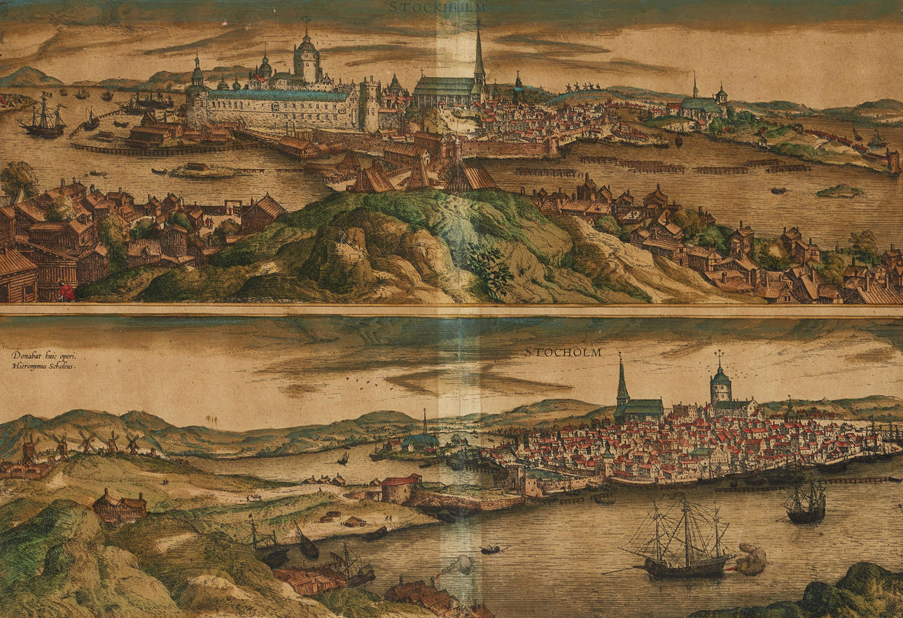
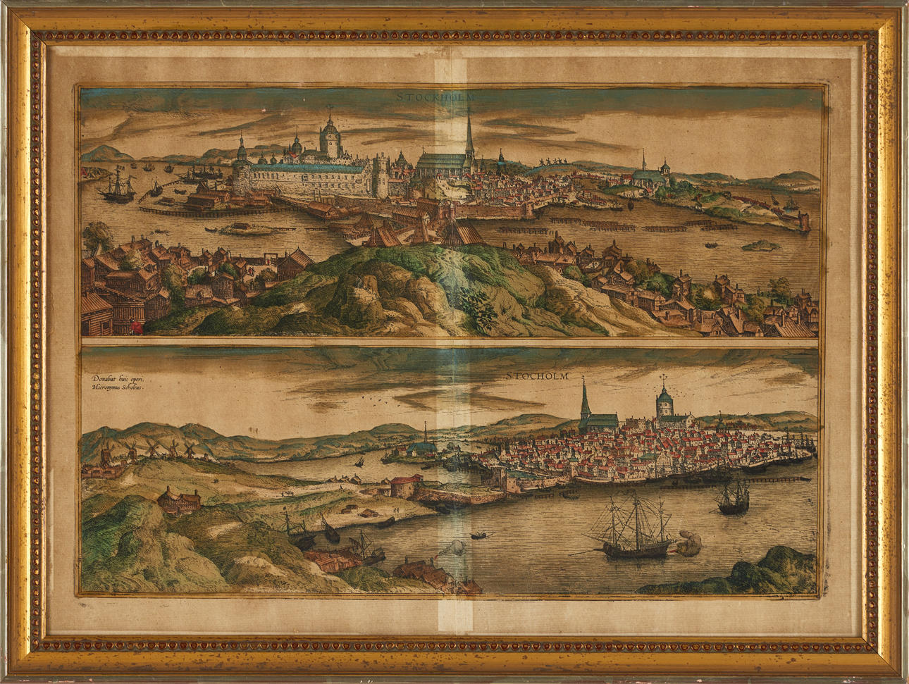
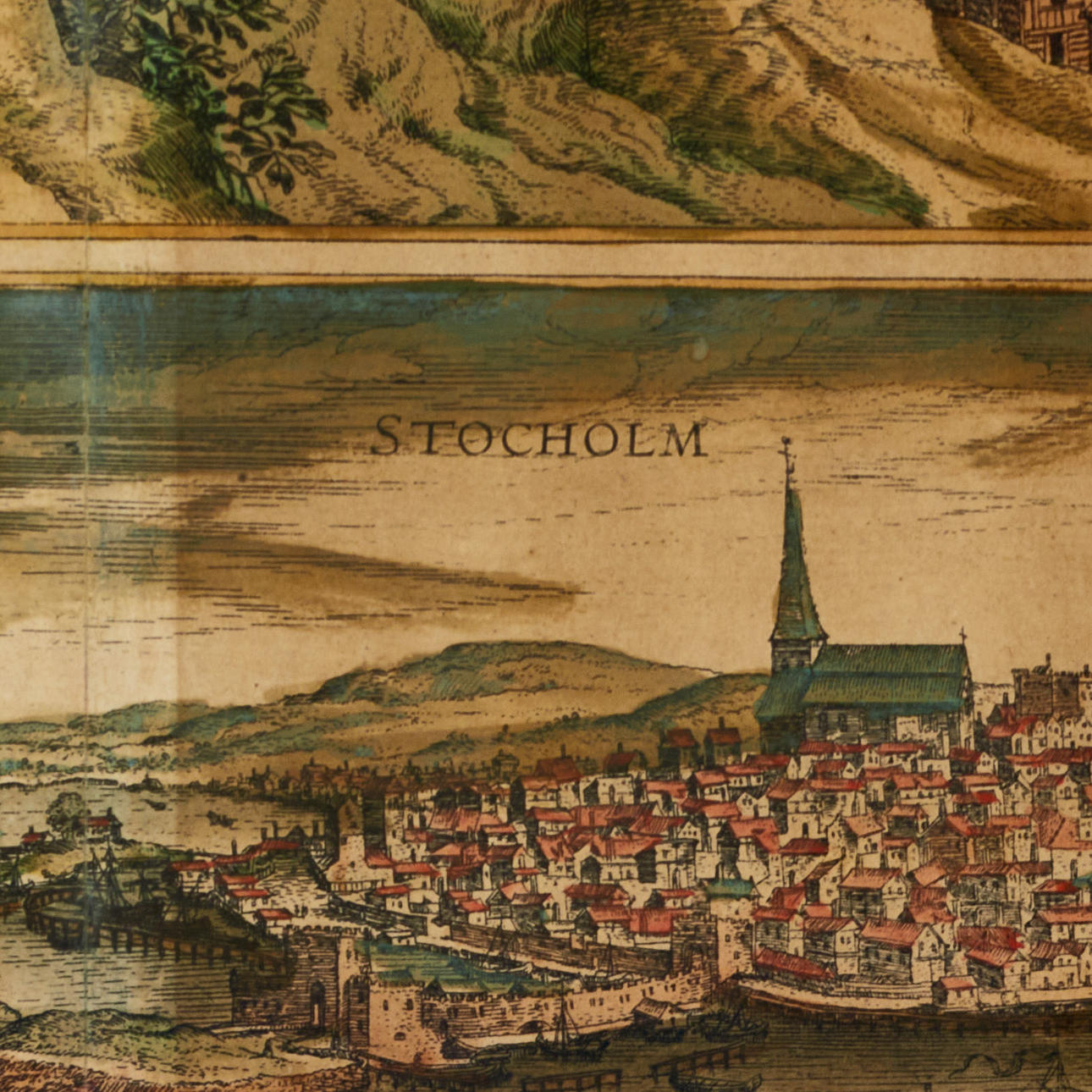
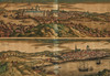
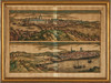
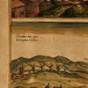
Georg Braun (1541-1622) /Frans Hogenberg (c. 1535-1590), engraved and hand-coloured city view of Stockholm, from “Civitates Orbis Terrarum”, Latin text (p. 38), c. 1590.
Plate: 32.6x47 cm.
Leaf: about 38x 51.8 cm.
The copperstick was originally published in the first atlas of cities, Civitates Orbis Terrarum, and one of the most important geographical and cartographic works of the modern era. Main publisher was Georg Braun, German theologian who, together with scientists and churchmen, wrote the Latin texts with information on history, geography, architecture, economy and culture for different regions. The work is an important historical source for the planning of the modern city and complemented by bird's-eye views of cities and their environs.
The first volume was published in 1572 in Cologne, and the work eventually came to consist of 6 volumes with over 500 illustrations published over a span of 45 years. The atlas contains views of various cities in Europe, North Africa, the Middle East, Asia and parts of the Americas. The number of overseas cities is only a few dozen, reflecting the very limited knowledge of geography outside Europe during the 16th century.
Many famous geographers and cartographers collaborated in the creation of the work. Central to the advent was Frans Hogenberg (1535-1590), Flemish/German painter and engraver who engraved most of the cityscapes in “Civitates Orbis Terrarum”.
After Frans Hogenberg's death, the plates were kept in Cologne, as an inheritance to his son Abraham Hogenberg. When Abraham passed out of time in 1653, the plates were sold to Johannes Janssonius, who in 1657 again began publishing the atlas with the views of the city. Now in eight volumes and in a completely revised form. The illustrations were arranged by country and a large number of new engravings had been added to the work, while excluding outdated images.
After Janssonius' death in 1664, his grandson, Johannes Janssonius van Waeseberg inherited the plates and he in turn used some of these for an atlas that came out in 1682.
In 1694, the plates were acquired by the prolific publisher Frederick de Wit who organized a new edition, which was also supplemented by additional engravings. By the turn of the century 1700, the plates were owned by the publisher Pieter van der Aa (1659-1733), who published the atlas in 1729. It in turn consists of a mixture deductions from the plates of the 16th and 17th centuries. Finally, the plates (bearing de Witt's address) were acquired by the publisher Coven & Mortier (the business was conducted from 1721 to about 1862).
The various editions printed, and the numerous reproductions of the pictures from “Civitates Orbis Terrarum” show the impact that this work had for a very long time. In addition to their historical and scientific significance, the work and images themselves possess great artistic value, and which still today attract both specialized collectors and passionate art lovers.
Condition
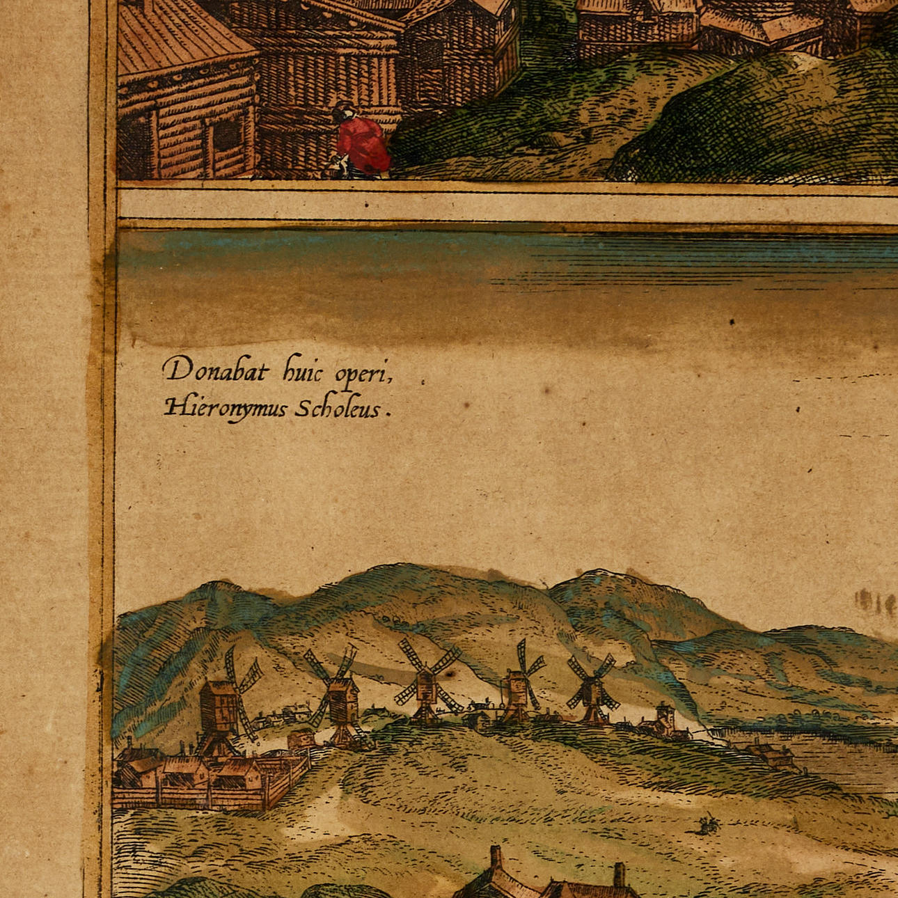
Discolored. Mittfold mended. Damage (papilla abscess) in the left margin. Tear in the lower margin of the leaf.
Theme
Description
Georg Braun (1541-1622) /Frans Hogenberg (c. 1535-1590), engraved and hand-coloured city view of Stockholm, from “Civitates Orbis Terrarum”, Latin text (p. 38), c. 1590.
Plate: 32.6x47 cm.
Leaf: about 38x 51.8 cm.
The copperstick was originally published in the first atlas of cities, Civitates Orbis Terrarum, and one of the most important geographical and cartographic works of the modern era. Main publisher was Georg Braun, German theologian who, together with scientists and churchmen, wrote the Latin texts with information on history, geography, architecture, economy and culture for different regions. The work is an important historical source for the planning of the modern city and complemented by bird's-eye views of cities and their environs.
The first volume was published in 1572 in Cologne, and the work eventually came to consist of 6 volumes with over 500 illustrations published over a span of 45 years. The atlas contains views of various cities in Europe, North Africa, the Middle East, Asia and parts of the Americas. The number of overseas cities is only a few dozen, reflecting the very limited knowledge of geography outside Europe during the 16th century.
Many famous geographers and cartographers collaborated in the creation of the work. Central to the advent was Frans Hogenberg (1535-1590), Flemish/German painter and engraver who engraved most of the cityscapes in “Civitates Orbis Terrarum”.
After Frans Hogenberg's death, the plates were kept in Cologne, as an inheritance to his son Abraham Hogenberg. When Abraham passed out of time in 1653, the plates were sold to Johannes Janssonius, who in 1657 again began publishing the atlas with the views of the city. Now in eight volumes and in a completely revised form. The illustrations were arranged by country and a large number of new engravings had been added to the work, while excluding outdated images.
After Janssonius' death in 1664, his grandson, Johannes Janssonius van Waeseberg inherited the plates and he in turn used some of these for an atlas that came out in 1682.
In 1694, the plates were acquired by the prolific publisher Frederick de Wit who organized a new edition, which was also supplemented by additional engravings. By the turn of the century 1700, the plates were owned by the publisher Pieter van der Aa (1659-1733), who published the atlas in 1729. It in turn consists of a mixture deductions from the plates of the 16th and 17th centuries. Finally, the plates (bearing de Witt's address) were acquired by the publisher Coven & Mortier (the business was conducted from 1721 to about 1862).
The various editions printed, and the numerous reproductions of the pictures from “Civitates Orbis Terrarum” show the impact that this work had for a very long time. In addition to their historical and scientific significance, the work and images themselves possess great artistic value, and which still today attract both specialized collectors and passionate art lovers.
Condition
Discolored. Mittfold mended. Damage (papilla abscess) in the left margin. Tear in the lower margin of the leaf.
Theme
Payment options for this item
Payment cardsBank transferDelivery
: Provide your locationInfo temporarily unavailableLoading…Provide your location to see transport options and prices.
Oops! Something went wrong.
Please try again in a moment. If it still doesn't work, contact Auctionet support.
Details
- Address
Galoppvägen 3
183 64 Täby
Sweden- Placement
- Tema tavlor 2 mellan