DE WIT, Regnum Neapolis, c. 1680.
This auction is closed, but maybe you like the following items?

Images
Description
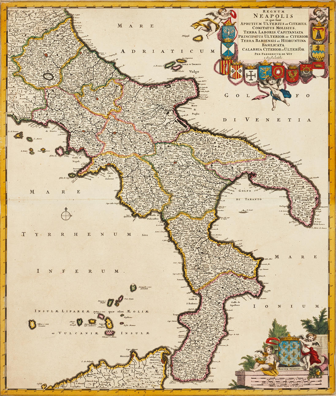
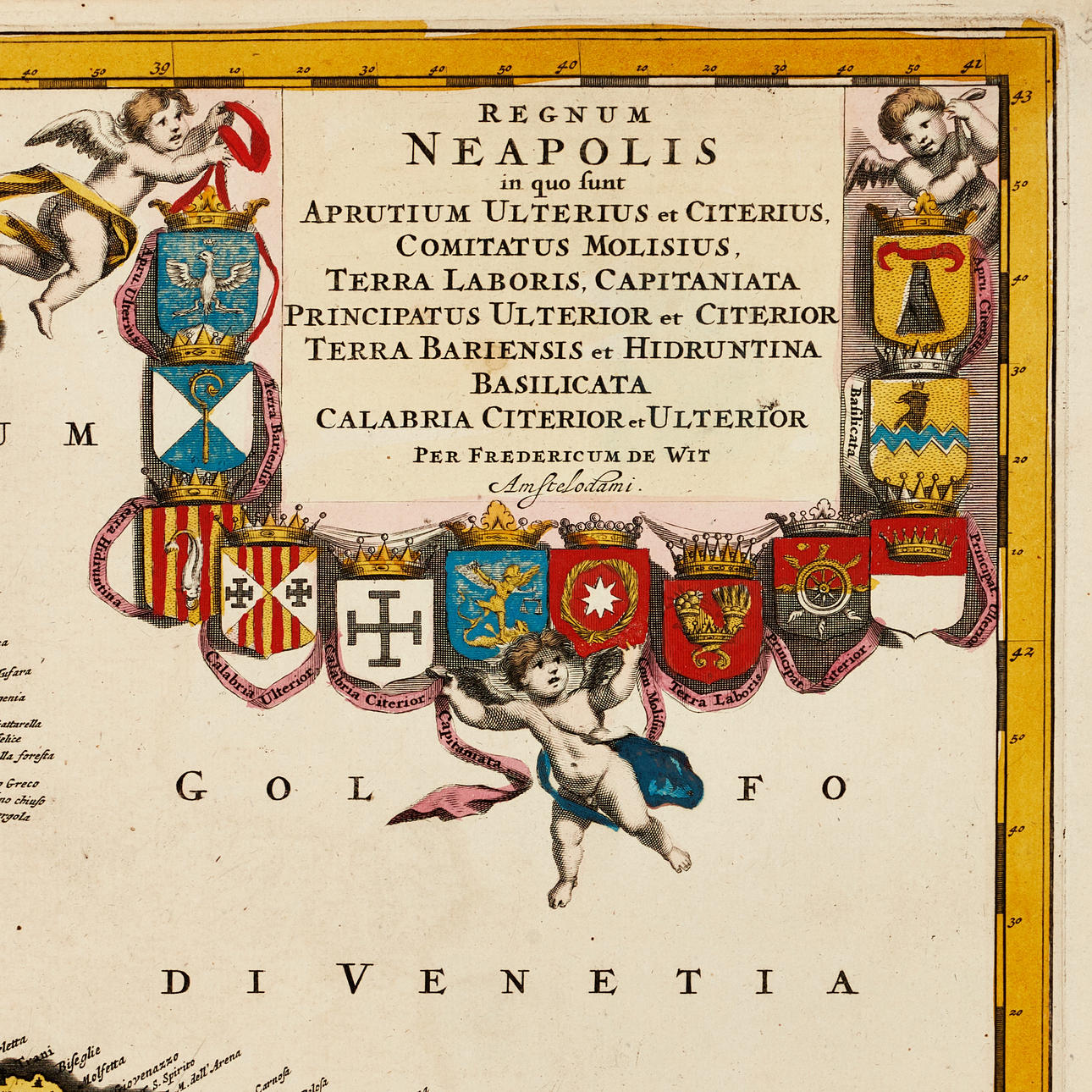
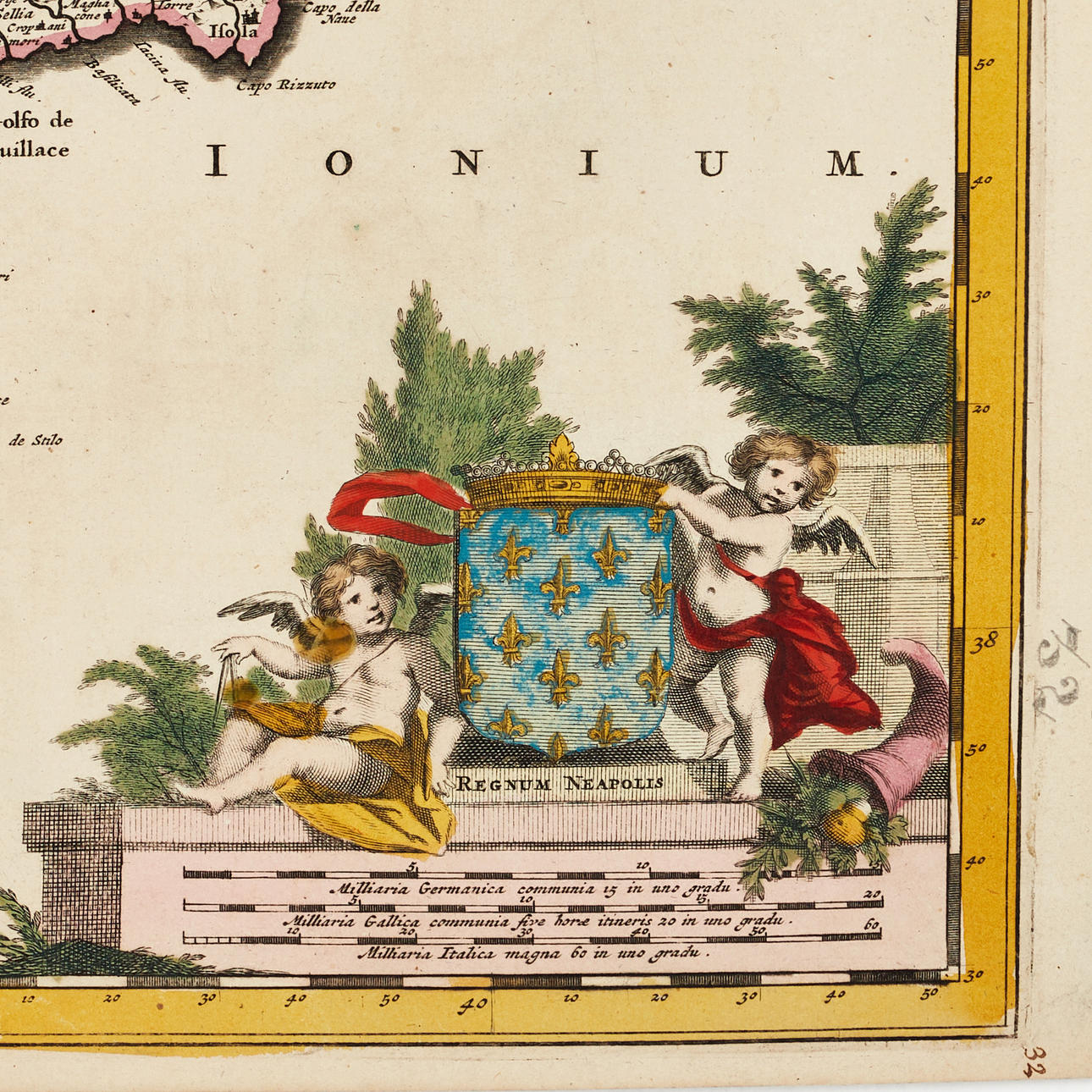
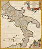
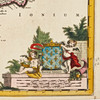
Frederick de Wit (1629-1706), “Regnum Neapolis in quo sunt Aprutium Ulterius et Citerius, Comitatus Molisius, Terra Laboris, Capitaniata Principatus Ulterior et Citerior Terra Bariensis et Hidruntina Basilicata Calabria Citerior et Ulterior...,”, engraved and hand-coloured map of the Kingdom of Naples, c. 1680.
Plate: 58.5 x 49.3 cm.
Leaf: about 52.2 x 59.6 cm.
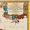
The map shows the southern parts of Italy and the Kingdom of Naples with L'Aquila, Gaeta, Naples, part of Sicily and Messina. Up in the right corner the large title cartouche with putti and 12 coats of arms. In the lower left corner cartouche with the measuring scale.
Frederick de Wit (1629 - 1706) originally worked for Willem Blaeu in Amsterdam, where he moved sometime before 1648. The first known work attributed to the hand of the hand, is an engraved plan of Haarlem (Antonius Sanderus' “Flandria Illustrata”). In 1654 de Wit started his own business, and likely the first map that he himself drew and engraved is a 1659 nautical chart of Denmark (“REGNI DANIÆ Accuratissima delineatio Perfeckte Kaerte van't CONJNCKRYCK DENEMARCKEN). A year later he released a major world map, “Nova Totius Terrarum Orbis Tabula”, which became much talked about and paved the way for his continued success. In the early 1660s he issued a large composite atlas, which ranged from 17 to 150 nautical charts and maps. After his death in 1706, his wife Maria continued the business as their son had no interest in the business. In 1710 Maria sold all the maps and plates at a public auction. Most of it was acquired by Pieter Mortier (1661-1711), later the successful firm of Covens & Mortier.
Condition
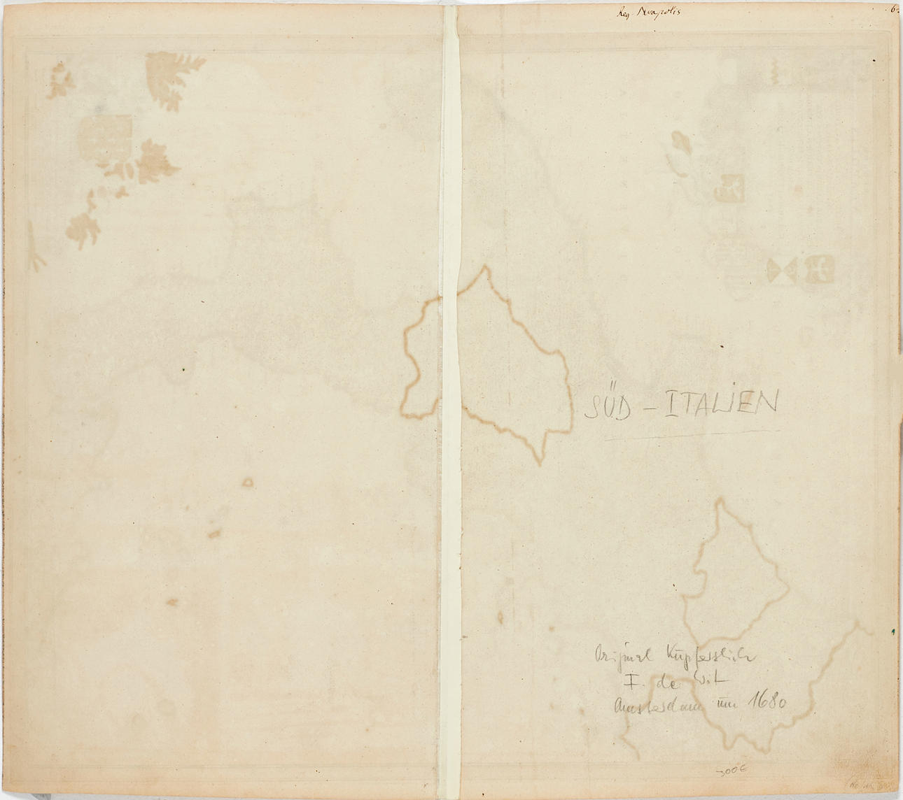
Yellowed, few small spots. The middle fold with tear (25mm) on the left (partly in the picture). Small hole in the upper part of the map (under the word “Vulgo”, at “Isole di Tremiti”).
Not framed.
Theme
Francesco Bacoccoli Collection - The Golden Era of Cartography: Part I
Do you have something similar to sell? Get your items valued free of charge!
Description
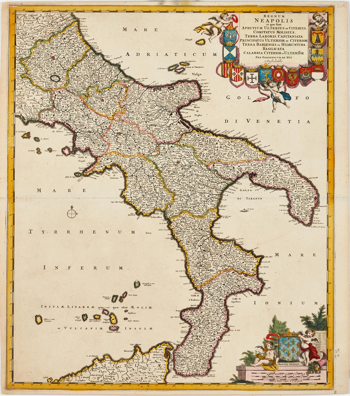
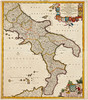
Frederick de Wit (1629-1706), “Regnum Neapolis in quo sunt Aprutium Ulterius et Citerius, Comitatus Molisius, Terra Laboris, Capitaniata Principatus Ulterior et Citerior Terra Bariensis et Hidruntina Basilicata Calabria Citerior et Ulterior...,”, engraved and hand-coloured map of the Kingdom of Naples, c. 1680.
Plate: 58.5 x 49.3 cm.
Leaf: about 52.2 x 59.6 cm.
The map shows the southern parts of Italy and the Kingdom of Naples with L'Aquila, Gaeta, Naples, part of Sicily and Messina. Up in the right corner the large title cartouche with putti and 12 coats of arms. In the lower left corner cartouche with the measuring scale.
Frederick de Wit (1629 - 1706) originally worked for Willem Blaeu in Amsterdam, where he moved sometime before 1648. The first known work attributed to the hand of the hand, is an engraved plan of Haarlem (Antonius Sanderus' “Flandria Illustrata”). In 1654 de Wit started his own business, and likely the first map that he himself drew and engraved is a 1659 nautical chart of Denmark (“REGNI DANIÆ Accuratissima delineatio Perfeckte Kaerte van't CONJNCKRYCK DENEMARCKEN). A year later he released a major world map, “Nova Totius Terrarum Orbis Tabula”, which became much talked about and paved the way for his continued success. In the early 1660s he issued a large composite atlas, which ranged from 17 to 150 nautical charts and maps. After his death in 1706, his wife Maria continued the business as their son had no interest in the business. In 1710 Maria sold all the maps and plates at a public auction. Most of it was acquired by Pieter Mortier (1661-1711), later the successful firm of Covens & Mortier.
Condition
Yellowed, few small spots. The middle fold with tear (25mm) on the left (partly in the picture). Small hole in the upper part of the map (under the word “Vulgo”, at “Isole di Tremiti”).
Not framed.
Theme
Francesco Bacoccoli Collection - The Golden Era of Cartography: Part I
Do you have something similar to sell? Get your items valued free of charge!