ORTELIUS, Zelandicarum insularum, 1603.
This auction is closed, but maybe you like the following items?

Images

Description
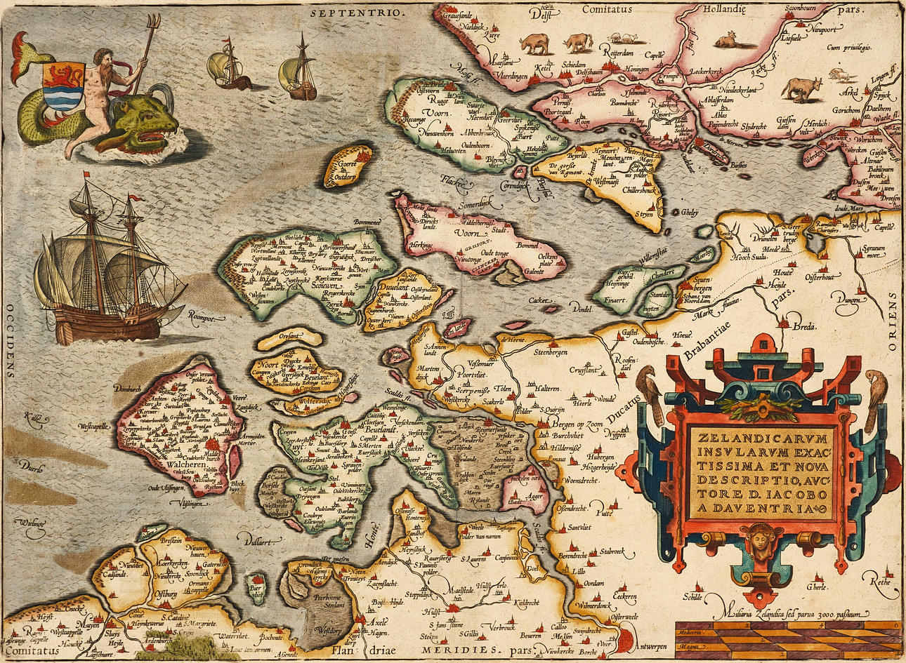
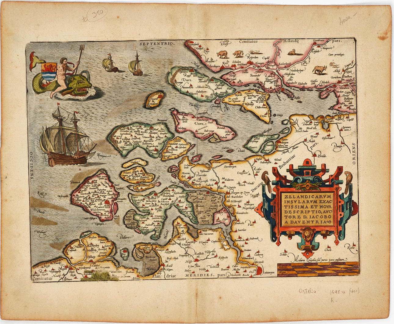
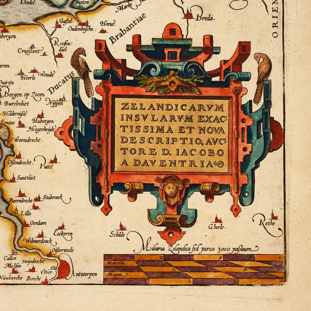
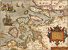
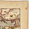
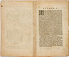
Abraham Ortelius (1527-1598), “Zelandicarum Insularum Exactissima Et Nova Descriptio, Auctore D. Jacobo A Daventria”, engraved and hand-coloured map of the province of Zeeland, from Ortelius' “Theatrum Orbis Terrarum”. Latin edition 1603 (1603L46 300 copies).
Plate: 33.5 x 46.5 cm.
Sheet: 45 x 55 cm (unidentified watermark).
LITERATURE: Van den Broecke, City 78.
Koeman/Meurer 18.
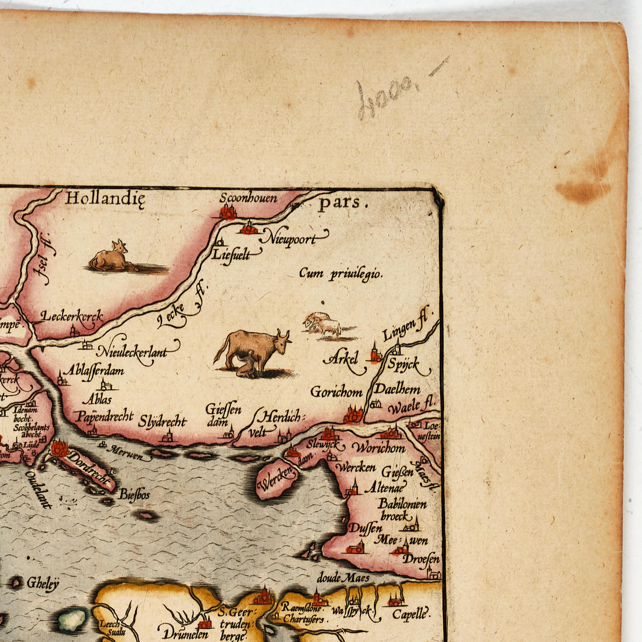
The map is based on a 1547 map by cartographer Jacobus van Deventer (c. 1500-1575), and shows the province of Zeeland with adjoining southern Holland, northern Brabant, and with part of northern Belgium. The cities of Middelburg [Middelburch], Bergan op Zoom, Rotterdam and Antwerp are marked
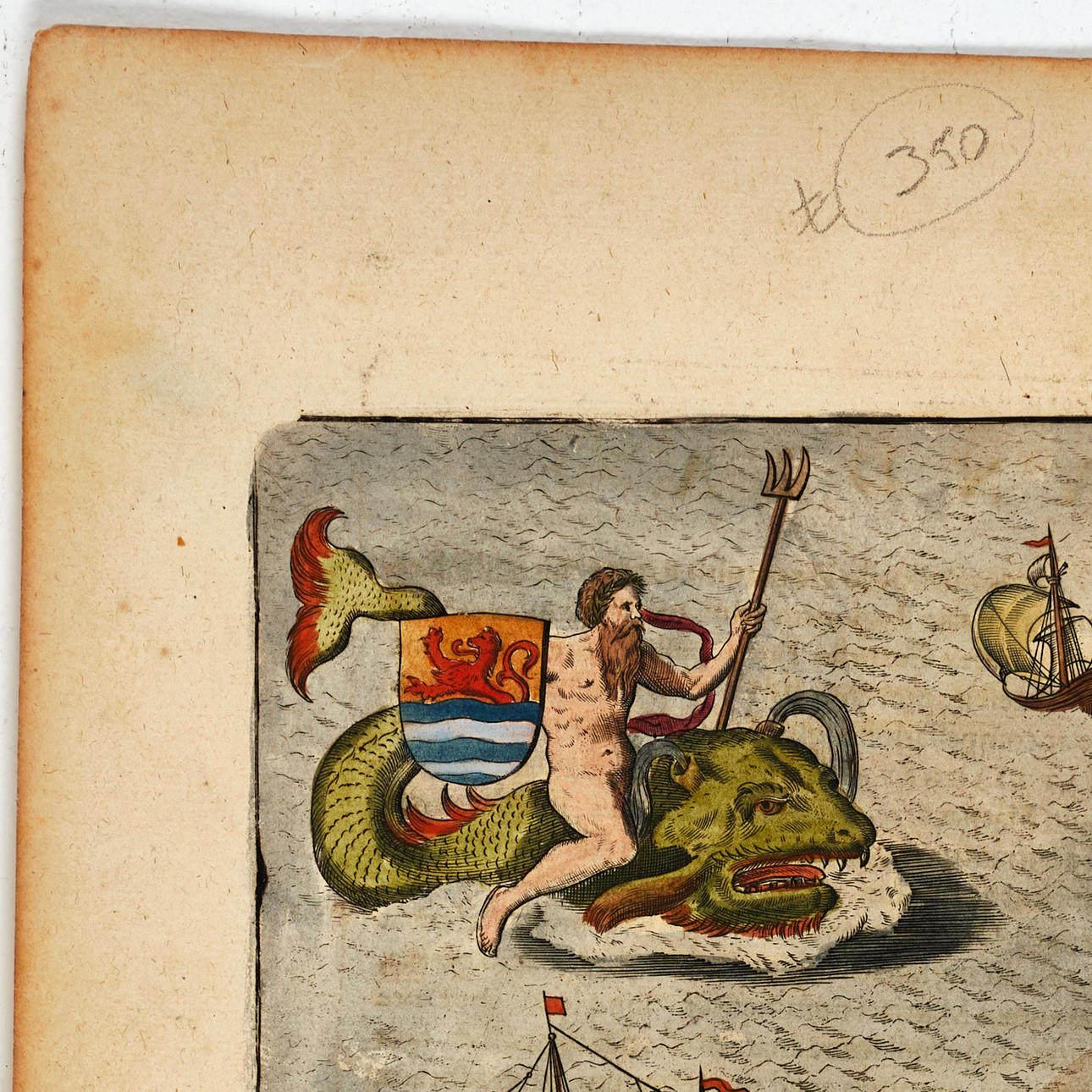
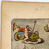
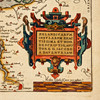
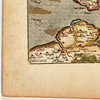
In the lower right corner the large, coloured title cartouche, and below it the measuring scale. In the upper right corner Poseidon riding a sea monster, bearing the provincial coat of arms depicting a lion fighting his way out of the waves, and three ships. On the upper part of the map, various livestock animals are depicted and a woman milking a cow.
Abraham Ortelius (1527-1598) was born in Antwerp and came to study Greek and Latin as well as mathematics. Together with his sisters Anne and Elisabeth, he colourised maps, but also traded in antiques, coins, books and maps. His business grew and so did his network of contacts with the scientists and book publishers of the time, which was also facilitated by the many trips he undertook in Europe.
In 1564, he published his first map, a map of the world that has survived only in a handful of copies. 1565 saw a map of Egypt and the Holy Land, as well as a map of Asia. In 1568 the production of individual maps for his atlas “Theatrum Orbis Terrarum” was in full swing and the following year, 1569 the atlas was completed. In May 1570 it was put up for sale to squatted speculators and was one of the costliest books ever published. The first edition consisted of 70 maps printed on 53 leaf sheets, and engraved by Frans Hogenberg. It became in great demand and some 24 editions were published during Ortelius' lifetime, and then another 10 editions in six different languages until 1612, the atlas also grew in the number of maps and pages after which new editions were published. The importance of Ortelius's atlas for the late 16th century understanding of the world and geographical knowledge cannot be emphasized enough. Today, Ortelius's atlas is often spoken of when referring to the “Theatrum Orbis Terrarum”, the term atlas itself, however, was first introduced over 20 years later by Mercator, but Ortelius was the one who, in the truest sense, created the first modern atlas.
Condition
Yellowed, spots. The middle fold with old reinforcement on the verso, and at the bottom with partially repaired tear (approx. 50mm).
Not framed.
Theme
Francesco Bacoccoli Collection - The Golden Era of Cartography: Part I
Do you have something similar to sell? Get your items valued free of charge!
Description
Abraham Ortelius (1527-1598), “Zelandicarum Insularum Exactissima Et Nova Descriptio, Auctore D. Jacobo A Daventria”, engraved and hand-coloured map of the province of Zeeland, from Ortelius' “Theatrum Orbis Terrarum”. Latin edition 1603 (1603L46 300 copies).
Plate: 33.5 x 46.5 cm.
Sheet: 45 x 55 cm (unidentified watermark).
LITERATURE: Van den Broecke, City 78.
Koeman/Meurer 18.
The map is based on a 1547 map by cartographer Jacobus van Deventer (c. 1500-1575), and shows the province of Zeeland with adjoining southern Holland, northern Brabant, and with part of northern Belgium. The cities of Middelburg [Middelburch], Bergan op Zoom, Rotterdam and Antwerp are marked
In the lower right corner the large, coloured title cartouche, and below it the measuring scale. In the upper right corner Poseidon riding a sea monster, bearing the provincial coat of arms depicting a lion fighting his way out of the waves, and three ships. On the upper part of the map, various livestock animals are depicted and a woman milking a cow.
Abraham Ortelius (1527-1598) was born in Antwerp and came to study Greek and Latin as well as mathematics. Together with his sisters Anne and Elisabeth, he colourised maps, but also traded in antiques, coins, books and maps. His business grew and so did his network of contacts with the scientists and book publishers of the time, which was also facilitated by the many trips he undertook in Europe.
In 1564, he published his first map, a map of the world that has survived only in a handful of copies. 1565 saw a map of Egypt and the Holy Land, as well as a map of Asia. In 1568 the production of individual maps for his atlas “Theatrum Orbis Terrarum” was in full swing and the following year, 1569 the atlas was completed. In May 1570 it was put up for sale to squatted speculators and was one of the costliest books ever published. The first edition consisted of 70 maps printed on 53 leaf sheets, and engraved by Frans Hogenberg. It became in great demand and some 24 editions were published during Ortelius' lifetime, and then another 10 editions in six different languages until 1612, the atlas also grew in the number of maps and pages after which new editions were published. The importance of Ortelius's atlas for the late 16th century understanding of the world and geographical knowledge cannot be emphasized enough. Today, Ortelius's atlas is often spoken of when referring to the “Theatrum Orbis Terrarum”, the term atlas itself, however, was first introduced over 20 years later by Mercator, but Ortelius was the one who, in the truest sense, created the first modern atlas.
Condition
Yellowed, spots. The middle fold with old reinforcement on the verso, and at the bottom with partially repaired tear (approx. 50mm).
Not framed.
Theme
Francesco Bacoccoli Collection - The Golden Era of Cartography: Part I
Do you have something similar to sell? Get your items valued free of charge!
Payment options for this item
Payment cardsBank transferDelivery
: Provide your locationInfo temporarily unavailableLoading…Provide your location to see transport options and prices.
Oops! Something went wrong.
Please try again in a moment. If it still doesn't work, contact Auctionet support.