DE WIT, Comitatus Zutphaniæ et Fluminis Isulæ, ca 1682.
This auction is closed, but maybe you like the following items?

Images
Description
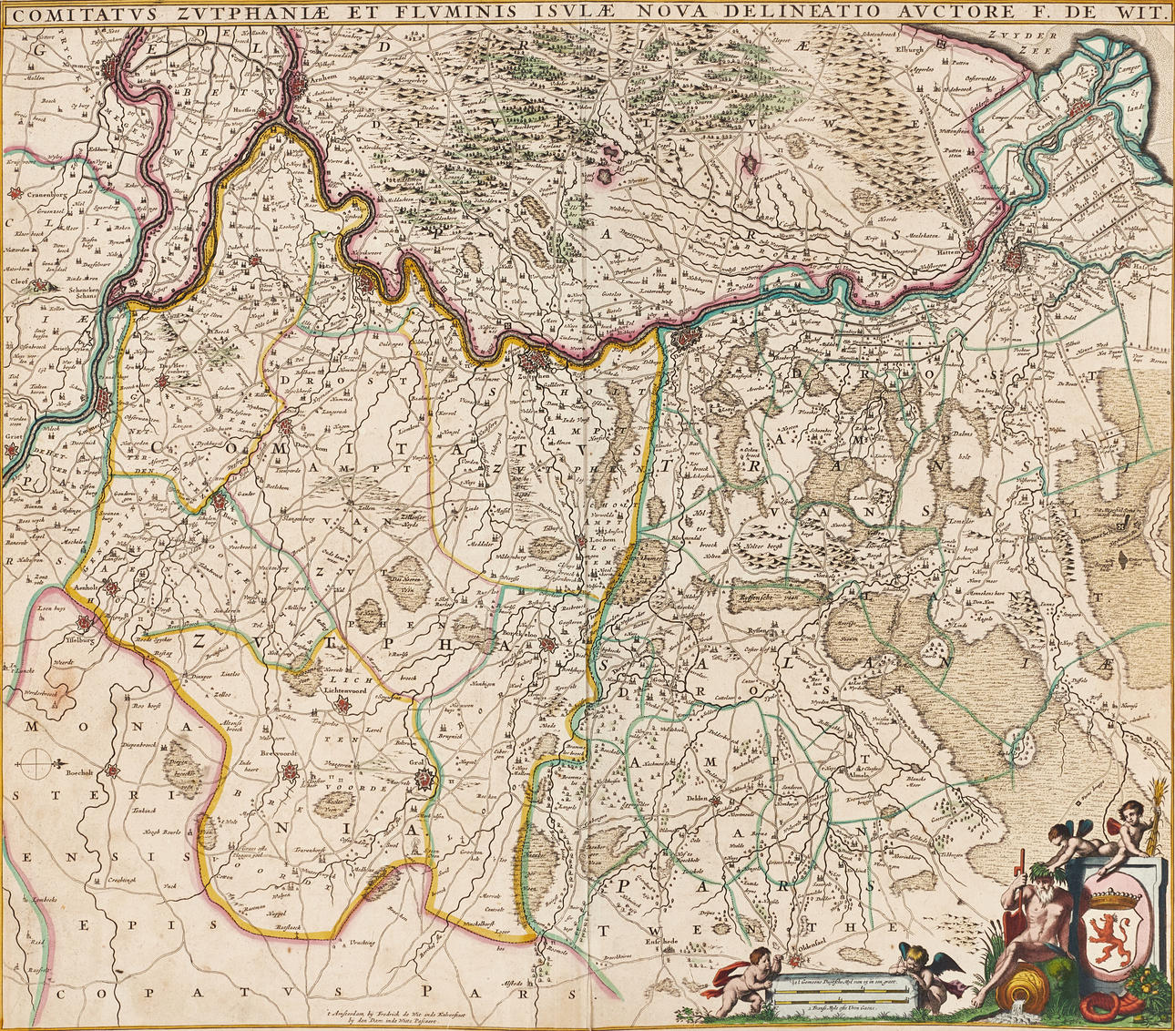
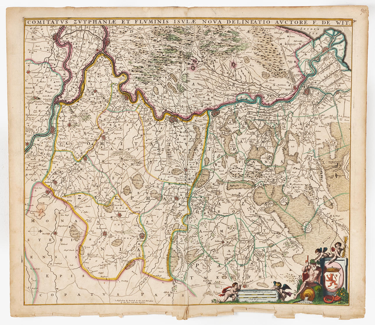
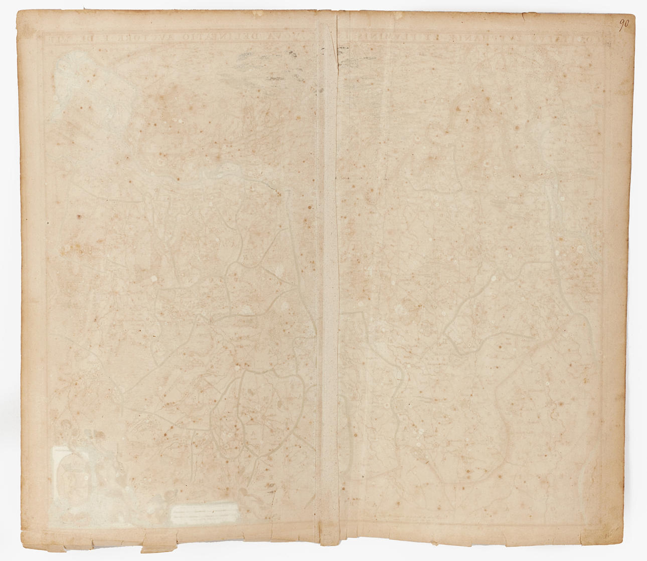
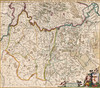
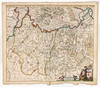
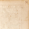
Frederick de Wit (1629-1706), “Comitatus Zutphaniæ et Fluminis Isulæ Nova Delineatio Auctore F. De Wit”, engraved and hand-coloured map of the county of Zuthphen and the river IJssel, c. 1682.
Plate: 49 x 56,5 cm.
Leaf: about 52.7 x 60.7 cm.
The map follows the river Ijssel northwards, from where it merges with the Rhine in the eastern parts of the Netherlands. It shows towns, parishes, estates and road networks in the county and part of neighbouring Guelders.
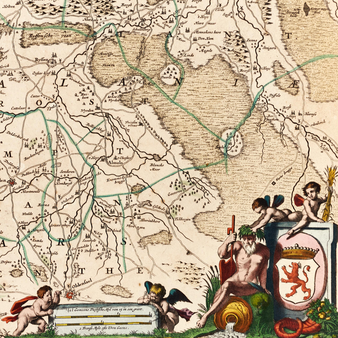
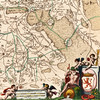
The river Ijssel is central to the region. Formations and small lakes are indicated on the map, highlighting the importance of water regulation in the area. In the cartouche at the bottom right is depicted the coat of arms of Zutphen.
Frederick de Wit (1629 - 1706) originally worked for Willem Blaeu in Amsterdam, where he moved sometime before 1648. The first known work attributed to the hand of the hand, is an engraved plan of Haarlem (Antonius Sanderus' “Flandria Illustrata”). In 1654 de Wit started his own business, and likely the first map that he himself drew and engraved is a 1659 nautical chart of Denmark (“REGNI DANIÆ Accuratissima delineatio Perfeckte Kaerte van't CONJNCKRYCK DENEMARCKEN). A year later he released a major world map, “Nova Totius Terrarum Orbis Tabula”, which became much talked about and paved the way for his continued success. In the early 1660s he issued a large composite atlas, which ranged from 17 to 150 nautical charts and maps. After his death in 1706, his wife Maria continued the business as their son had no interest in the business. In 1710 Maria sold all the maps and plates at a public auction. Most of it was acquired by Pieter Mortier (1661-1711), later the successful firm of Covens & Mortier.
Condition
Yellowed, spots. Folds. The bottom of the map and the margin with the majority of tears (about 3-4 in the image surface) and damage. A few tears in the upper margin. Upper right corner with inscriptions in ink.
Not framed.
Theme
Francesco Bacoccoli Collection - The Golden Era of Cartography: Part I
Do you have something similar to sell? Get your items valued free of charge!
Description
Frederick de Wit (1629-1706), “Comitatus Zutphaniæ et Fluminis Isulæ Nova Delineatio Auctore F. De Wit”, engraved and hand-coloured map of the county of Zuthphen and the river IJssel, c. 1682.
Plate: 49 x 56,5 cm.
Leaf: about 52.7 x 60.7 cm.
The map follows the river Ijssel northwards, from where it merges with the Rhine in the eastern parts of the Netherlands. It shows towns, parishes, estates and road networks in the county and part of neighbouring Guelders.
The river Ijssel is central to the region. Formations and small lakes are indicated on the map, highlighting the importance of water regulation in the area. In the cartouche at the bottom right is depicted the coat of arms of Zutphen.
Frederick de Wit (1629 - 1706) originally worked for Willem Blaeu in Amsterdam, where he moved sometime before 1648. The first known work attributed to the hand of the hand, is an engraved plan of Haarlem (Antonius Sanderus' “Flandria Illustrata”). In 1654 de Wit started his own business, and likely the first map that he himself drew and engraved is a 1659 nautical chart of Denmark (“REGNI DANIÆ Accuratissima delineatio Perfeckte Kaerte van't CONJNCKRYCK DENEMARCKEN). A year later he released a major world map, “Nova Totius Terrarum Orbis Tabula”, which became much talked about and paved the way for his continued success. In the early 1660s he issued a large composite atlas, which ranged from 17 to 150 nautical charts and maps. After his death in 1706, his wife Maria continued the business as their son had no interest in the business. In 1710 Maria sold all the maps and plates at a public auction. Most of it was acquired by Pieter Mortier (1661-1711), later the successful firm of Covens & Mortier.
Condition
Yellowed, spots. Folds. The bottom of the map and the margin with the majority of tears (about 3-4 in the image surface) and damage. A few tears in the upper margin. Upper right corner with inscriptions in ink.
Not framed.
Theme
Francesco Bacoccoli Collection - The Golden Era of Cartography: Part I
Do you have something similar to sell? Get your items valued free of charge!