ROBERT DE VAUGONDY, Royaume de Danemarck, c. 1750.
This auction is closed, but maybe you like the following items?
4837749. ROBERT DE VAUGONDY, Royaume de Danemarck, c. 1750.
Images
4837749. ROBERT DE VAUGONDY, Royaume de Danemarck, c. 1750.
Description
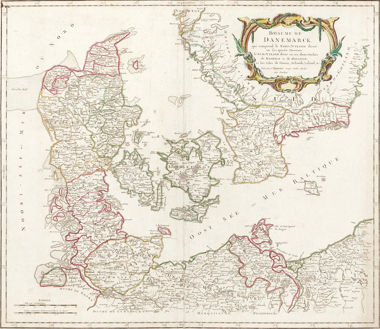
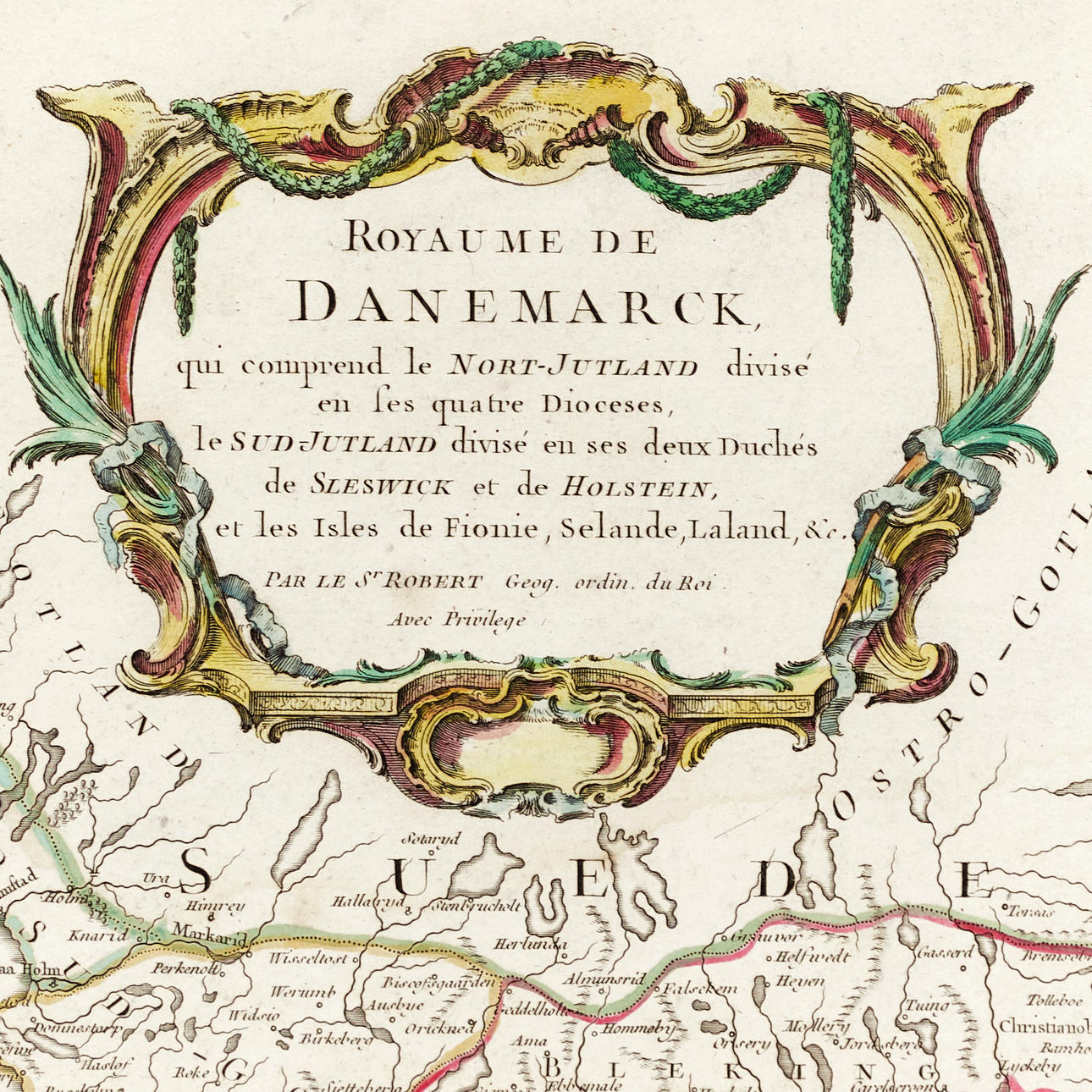
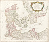
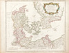
Gilles Robert de Vaugondy (1688-1766) & Didier Robert de Vaugondy (1723-1786), "Royaume de Danemarck, qui comprend le Nort-Jutland divisé en ses quatre Dioceses, le Sud-Jutland divisé en ses deux Duchés de Sleswick et de Hosltein, et les isles de Fionie, Selande, Laland,...", from "Atlas Universel", engraved and outline-colored map of Denmark, southernmost Sweden, and Northern Germany, c. 1750 (published in Paris 1757).
Plate: 50.2 x 58.5 cm.
Sheet: 51.2 x 66 cm.
In 1757, "Atlas Universel" was published, one of the most important atlases of the 18th century. Father and son Vaugondy examined and corrected older maps and sources, verifying longitude and latitude with astronomical observations. The older material was revised and supplemented with many new place names. The family was related to the cartographer Nicolas Sanson through his grandson Pierre Moulard-Sanson, from whom they inherited the majority of Sanson's cartographic material. Another important foundation for the work on "Atlas Universel" consisted of maps and plates acquired from the cartographer Hubert Jaillot.
In the work on the maps of Canada and South America, information was sourced from the Dépôt de la Marine (Dépôt des Cartes et Plans de la Marine). Just like Ortelius and Mercator, father and son Vaugondy cited their sources, which has facilitated the study of the history of cartography during this period.
Didier Robert de Vaugondy was appointed geographer to Louis XV in 1760.
Condition
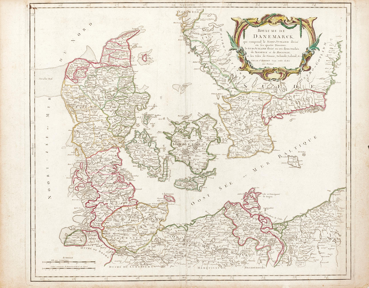
Yellowed, stained. Surface dirt. Creases along and across the center fold. Upper and lower parts of the center fold with tears (35mm, 50mm, into the image). Damage and small tears (approx. 5-12 mm) along the edges/margins of the sheet. Some tears (10-25mm) in the image area at the top edge of the sheet. Paper thinning along the center fold on the verso. Ink inscription on the verso visible through to the upper left corner of the image.
Unframed.
4837749. ROBERT DE VAUGONDY, Royaume de Danemarck, c. 1750.
Description
Gilles Robert de Vaugondy (1688-1766) & Didier Robert de Vaugondy (1723-1786), "Royaume de Danemarck, qui comprend le Nort-Jutland divisé en ses quatre Dioceses, le Sud-Jutland divisé en ses deux Duchés de Sleswick et de Hosltein, et les isles de Fionie, Selande, Laland,...", from "Atlas Universel", engraved and outline-colored map of Denmark, southernmost Sweden, and Northern Germany, c. 1750 (published in Paris 1757).
Plate: 50.2 x 58.5 cm.
Sheet: 51.2 x 66 cm.
In 1757, "Atlas Universel" was published, one of the most important atlases of the 18th century. Father and son Vaugondy examined and corrected older maps and sources, verifying longitude and latitude with astronomical observations. The older material was revised and supplemented with many new place names. The family was related to the cartographer Nicolas Sanson through his grandson Pierre Moulard-Sanson, from whom they inherited the majority of Sanson's cartographic material. Another important foundation for the work on "Atlas Universel" consisted of maps and plates acquired from the cartographer Hubert Jaillot.
In the work on the maps of Canada and South America, information was sourced from the Dépôt de la Marine (Dépôt des Cartes et Plans de la Marine). Just like Ortelius and Mercator, father and son Vaugondy cited their sources, which has facilitated the study of the history of cartography during this period.
Didier Robert de Vaugondy was appointed geographer to Louis XV in 1760.
Condition
Yellowed, stained. Surface dirt. Creases along and across the center fold. Upper and lower parts of the center fold with tears (35mm, 50mm, into the image). Damage and small tears (approx. 5-12 mm) along the edges/margins of the sheet. Some tears (10-25mm) in the image area at the top edge of the sheet. Paper thinning along the center fold on the verso. Ink inscription on the verso visible through to the upper left corner of the image.
Unframed.