JANSSONIUS, Mar del Nort, 1659.
This auction is closed, but maybe you like the following items?

Images

Description
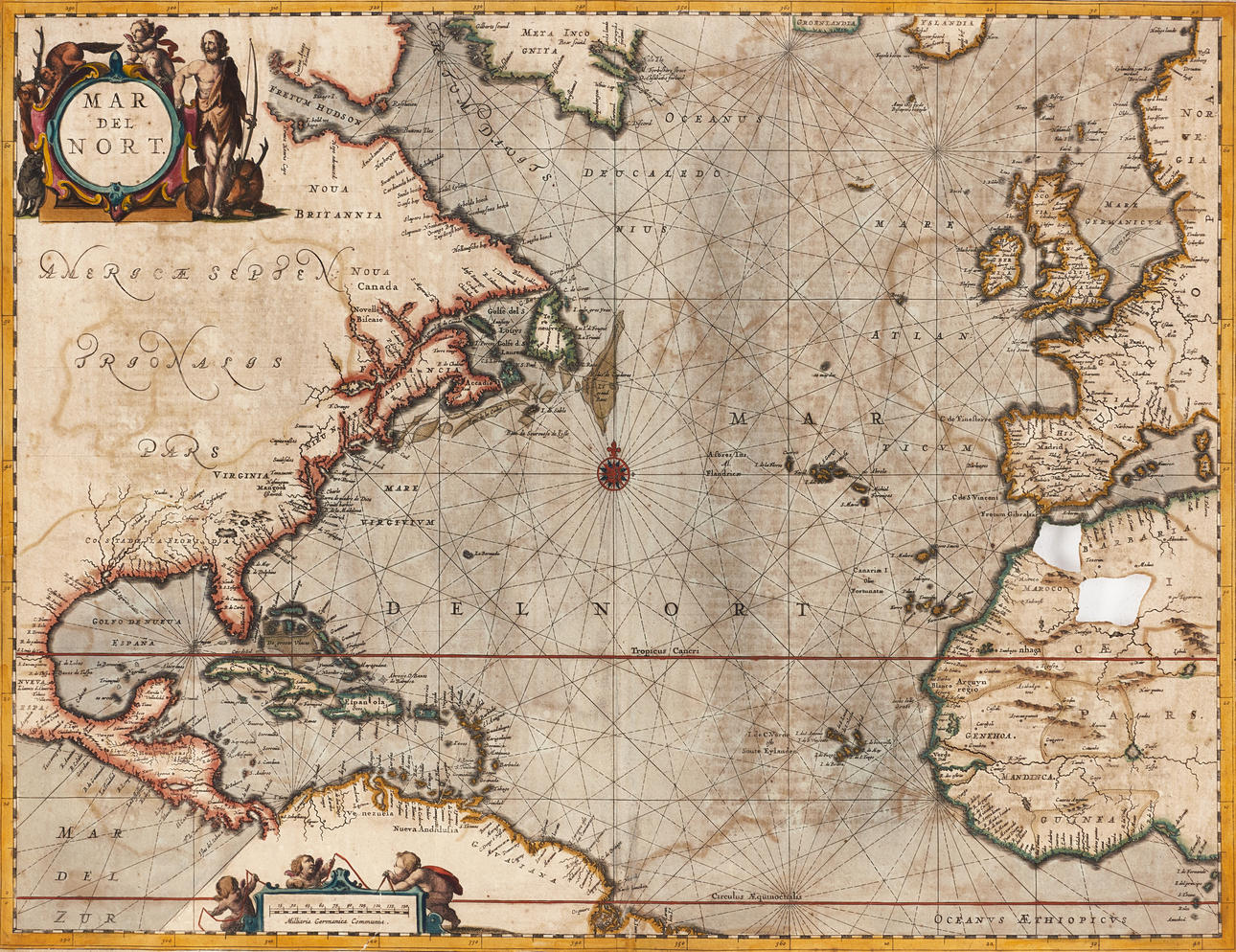
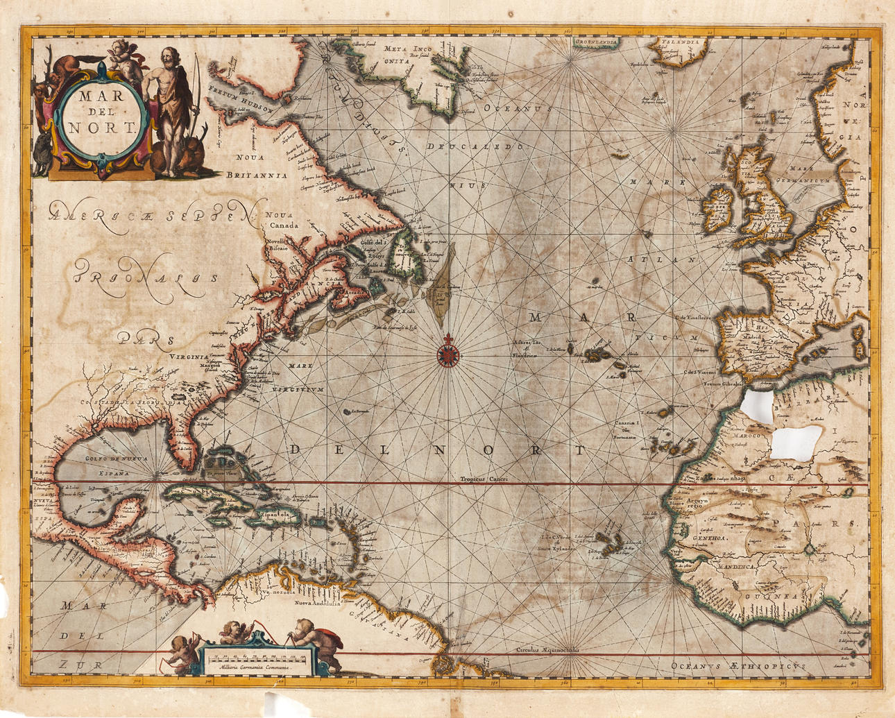
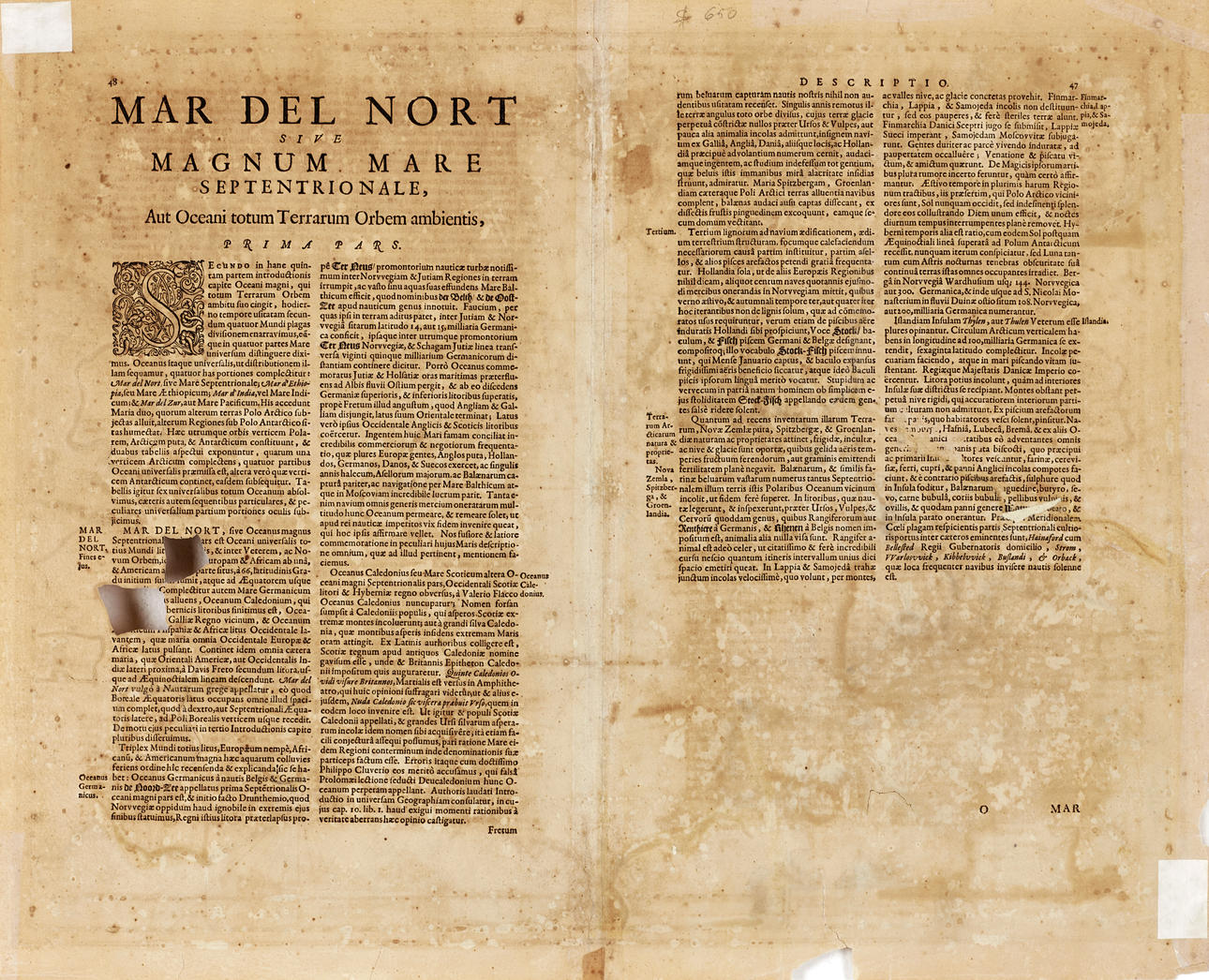
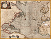
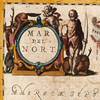
Johannes Janssonius (Jansson, 1588-1664), “Mar del Nort (Sive Magnum Mare Septentrionale,...), engraved and hand-colored nautical chart of the North Atlantic with the east coast of the Americas, Central America, the Gulf of Mexico and the Caribbean, the British Isles, part of western Europe and western Africa. Northeast of Canada is a large landmass designated “Meta Incognita”. The southernmost part of Greenland as well as Iceland are also rendered. 1659, Latin text, from "Atlas Novus”.
Plate: 43.3 x 56.2 cm.
Leaf: 46.6 x 58.4 cm.
LITERATURE: Koeman 0101:1
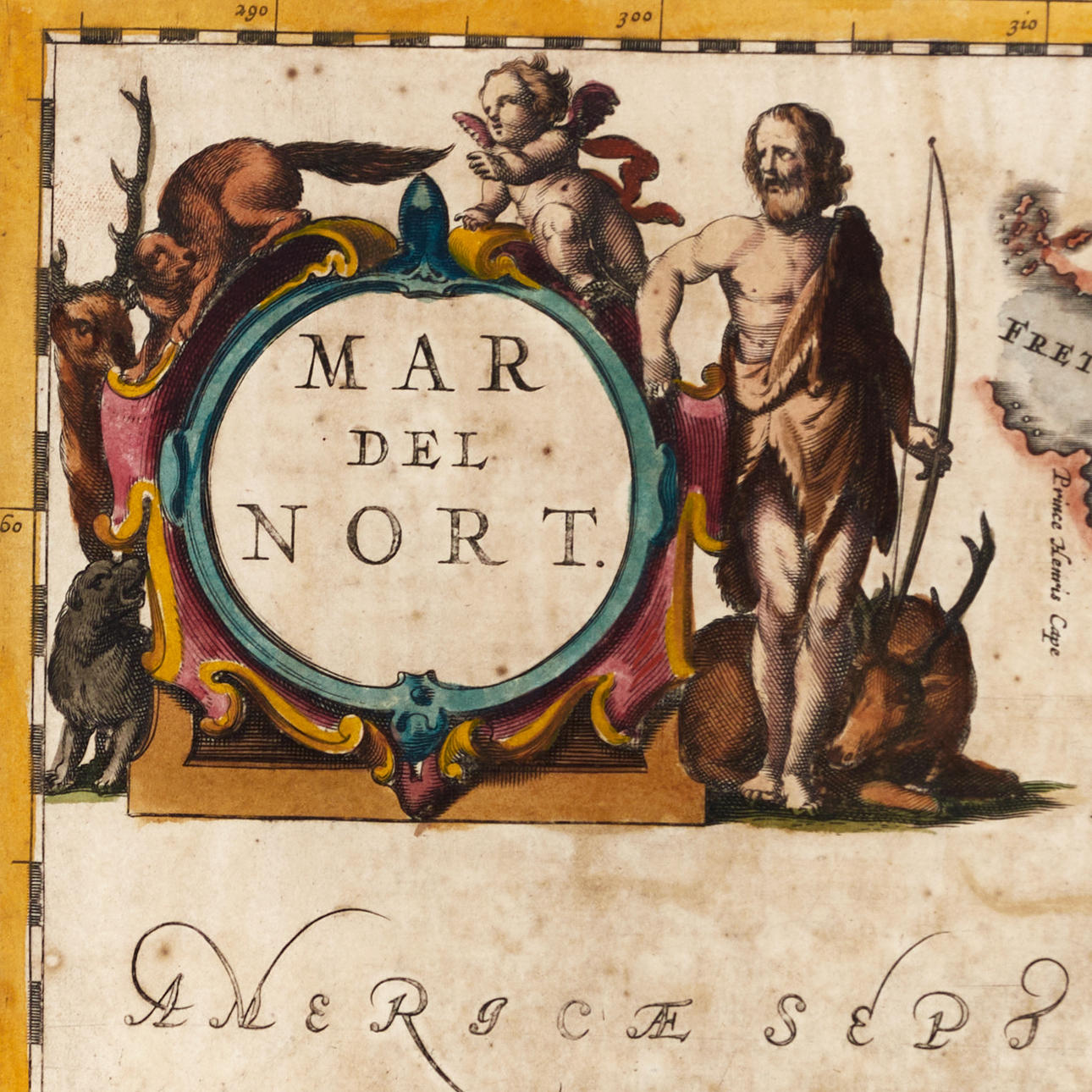
The cartography is, with some modifications, similar to earlier maps by Hondius and Janssonius. The surface is traversed by various nautical lines that converge in a compass rose. Top left a decorative cartouche with archer, a putto and various animals. At the bottom a decorative scale indication with three putti.
“Mar del Nort” was first published in 1650, as one of the 23 maps in the “Orbem Maritimum”, the fifth volume of Janssonius's Atlas Novus.
Johannes Janssonius (Jansson, 1588-1664) was a contemporary competitor in Amsterdam, the then European centre for the production of maps to the cartographer Willem Janszoon Blaeu. Janssonius' earliest work is a map of France and Italy in 1616. In 1612 he married Elisabeth de Hondt, sister of cartographer Henricus Hondius (1597-1651) and Jodocus Hondius II (1593-1629) with whom he began cohabitation in 1628. The brothers' father Jodocus Hondius I (1563-1612) had around 1604 acquired the copper plates after Mercator and issued a completely revised edition of Mercator's “Atlas” in 1606. Under Janssonius' leadership, Hondius' atlas was constantly expanded. It was given a new title, “Atlas Novus” and consisted of three volumes in 1638 of which one was entirely devoted to Italy. In 1646, the fourth volume was published with maps of England, which was a year after a similar Atlas published by Blaeu. The competitors' maps are reminiscent of each other, and Janssonius is often accused of copying Blaeu but Janssonius's maps are often slightly earlier than Blaue's and sometimes cover different regions. In 1650, “Orbem Maritimus was issued where “Mar del Nort” is one of the 33 maps in the fifth volume. By 1660, the atlas had finally been named “Atlas Maior” and consisted of 11 volumes. Editions were printed in Dutch, Latin, French and a few times in German. Upon the death of Henricus Hondius in 1651, Janssonius took over his business and Janssonius's business was later taken over by Peter Schenk, who republished his “Atlas Maior” around 1683.
Condition
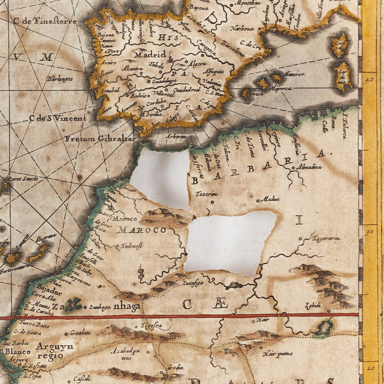
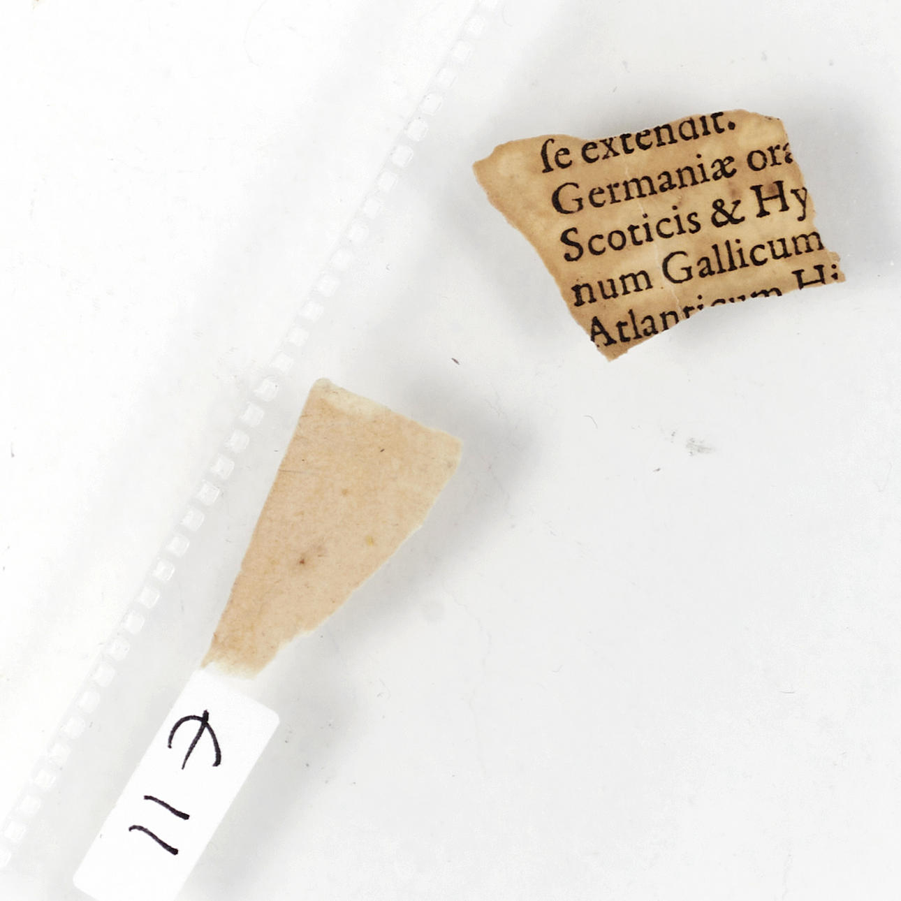
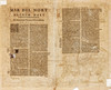
Extensive damage and repairs. Yellowed, spots and discolorations. The majority of tears (also in the picture) and old repairs, paper losses in the margin. Two cut-out parts in the map of Africa, one of which is missing (over the city of Fez).
Not ramat.
Theme
Francesco Bacoccoli Collection - The Golden Era of Cartography: Part I
Do you have something similar to sell? Get your items valued free of charge!
Description
Johannes Janssonius (Jansson, 1588-1664), “Mar del Nort (Sive Magnum Mare Septentrionale,...), engraved and hand-colored nautical chart of the North Atlantic with the east coast of the Americas, Central America, the Gulf of Mexico and the Caribbean, the British Isles, part of western Europe and western Africa. Northeast of Canada is a large landmass designated “Meta Incognita”. The southernmost part of Greenland as well as Iceland are also rendered. 1659, Latin text, from "Atlas Novus”.
Plate: 43.3 x 56.2 cm.
Leaf: 46.6 x 58.4 cm.
LITERATURE: Koeman 0101:1
The cartography is, with some modifications, similar to earlier maps by Hondius and Janssonius. The surface is traversed by various nautical lines that converge in a compass rose. Top left a decorative cartouche with archer, a putto and various animals. At the bottom a decorative scale indication with three putti.
“Mar del Nort” was first published in 1650, as one of the 23 maps in the “Orbem Maritimum”, the fifth volume of Janssonius's Atlas Novus.
Johannes Janssonius (Jansson, 1588-1664) was a contemporary competitor in Amsterdam, the then European centre for the production of maps to the cartographer Willem Janszoon Blaeu. Janssonius' earliest work is a map of France and Italy in 1616. In 1612 he married Elisabeth de Hondt, sister of cartographer Henricus Hondius (1597-1651) and Jodocus Hondius II (1593-1629) with whom he began cohabitation in 1628. The brothers' father Jodocus Hondius I (1563-1612) had around 1604 acquired the copper plates after Mercator and issued a completely revised edition of Mercator's “Atlas” in 1606. Under Janssonius' leadership, Hondius' atlas was constantly expanded. It was given a new title, “Atlas Novus” and consisted of three volumes in 1638 of which one was entirely devoted to Italy. In 1646, the fourth volume was published with maps of England, which was a year after a similar Atlas published by Blaeu. The competitors' maps are reminiscent of each other, and Janssonius is often accused of copying Blaeu but Janssonius's maps are often slightly earlier than Blaue's and sometimes cover different regions. In 1650, “Orbem Maritimus was issued where “Mar del Nort” is one of the 33 maps in the fifth volume. By 1660, the atlas had finally been named “Atlas Maior” and consisted of 11 volumes. Editions were printed in Dutch, Latin, French and a few times in German. Upon the death of Henricus Hondius in 1651, Janssonius took over his business and Janssonius's business was later taken over by Peter Schenk, who republished his “Atlas Maior” around 1683.
Condition
Extensive damage and repairs. Yellowed, spots and discolorations. The majority of tears (also in the picture) and old repairs, paper losses in the margin. Two cut-out parts in the map of Africa, one of which is missing (over the city of Fez).
Not ramat.
Theme
Francesco Bacoccoli Collection - The Golden Era of Cartography: Part I
Do you have something similar to sell? Get your items valued free of charge!