ORTELIUS, Indiae Orientalis, Insularumque Adiacentium Typus, 1573.
This auction is closed, but maybe you like the following items?

Images
Description
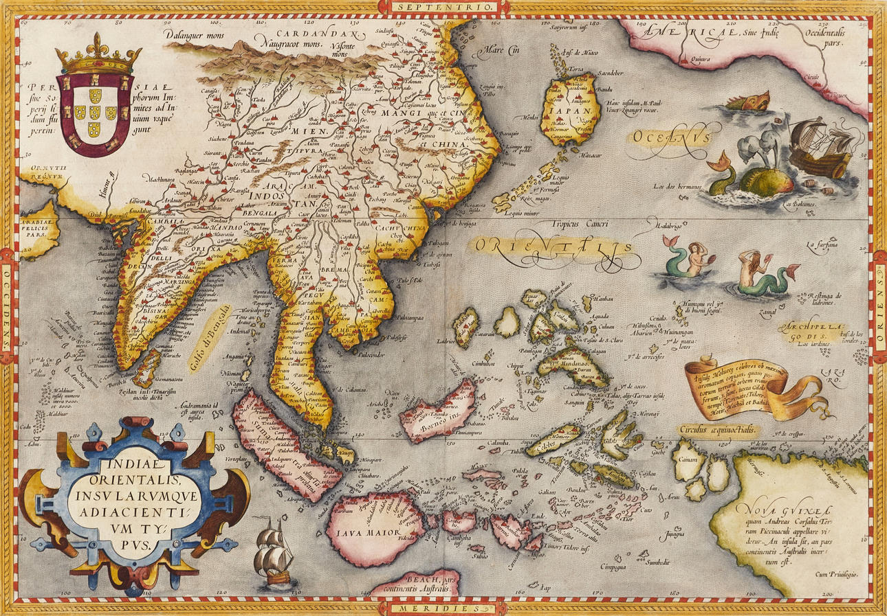
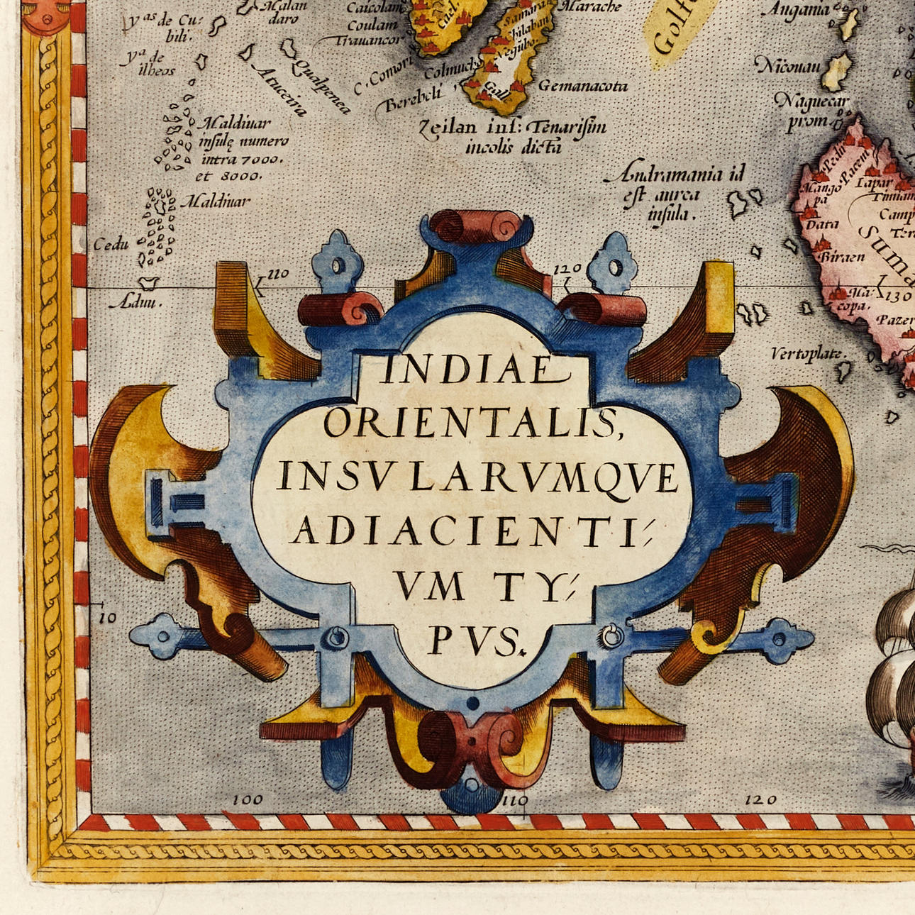
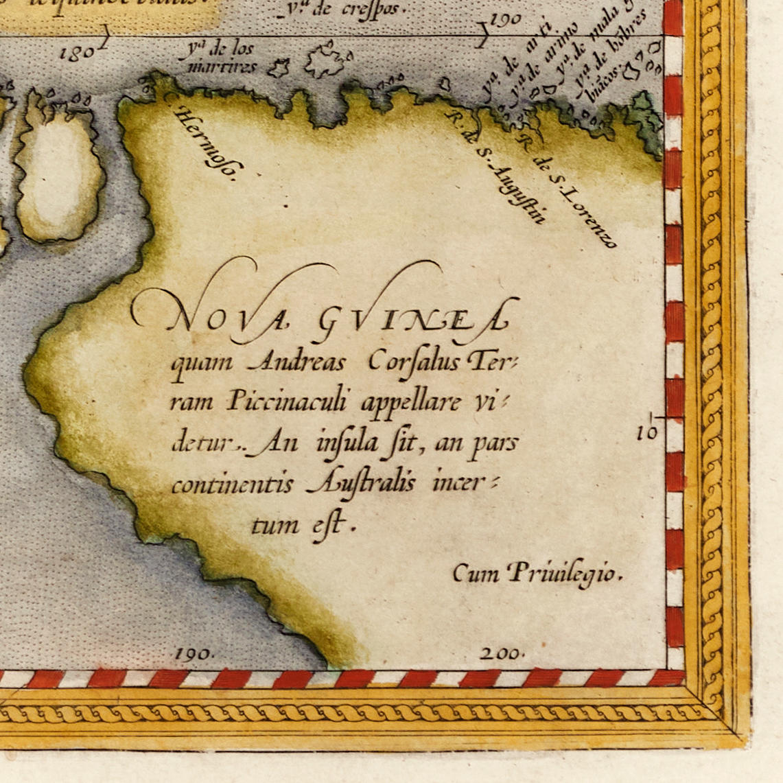
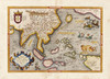
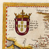
Abraham Ortelius, “Indiae Orientalis, Insularumque Adiacentium Typus”, engraved and hand-coloured map of East Asia and surrounding islands, 1573, from Ortelius' “Theatrum Orbis Terrarum”. Latin edition 1573 (1573L (A) 63, 40 copies).
Plate: 34.8 x 49.7 cm.
Leaf: 42,2 x 58,2 cm (watermark “Crossed arrows”).
LITERATURE: Van den Broecke, City 166.
Koeman/Meurer 48.
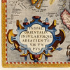
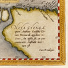
Great difficulties in mapping this island group caused maps of this area to remain inaccurate for the next centuries. Sumatra and Java appear excessively large and the Philippines is not fully extirpated where the northern island of Luzon is missing.
The seagulls on the right of the map are based on those reproduced on Diego Gutiérrez's map of the Americas (Cock, 1562).
Abraham Ortelius (1527-1598) was born in Antwerp and came to study Greek and Latin as well as mathematics. Together with his sisters Anne and Elisabeth, he colourised maps, but also traded in antiques, coins, books and maps. His business grew and so did his network of contacts with the scientists and book publishers of the time, which was also facilitated by the many trips he undertook in Europe.
In 1564, he published his first map, a map of the world that has survived only in a handful of copies. 1565 saw a map of Egypt and the Holy Land, as well as a map of Asia. In 1568 the production of individual maps for his atlas “Theatrum Orbis Terrarum” was in full swing and the following year, 1569 the atlas was completed. In May 1570 it was put up for sale to squatted speculators and was one of the costliest books ever published. The first edition consisted of 70 maps printed on 53 leaf sheets, and engraved by Frans Hogenberg. It became in great demand and some 24 editions were published during Ortelius' lifetime, and then another 10 editions in six different languages until 1612, the atlas also grew in the number of maps and pages after which new editions were published. The importance of Ortelius's atlas for the late 16th century understanding of the world and geographical knowledge cannot be emphasized enough. Today, Ortelius's atlas is often spoken of when referring to the “Theatrum Orbis Terrarum”, the term atlas itself, however, was first introduced over 20 years later by Mercator, but Ortelius was the one who, in the truest sense, created the first modern atlas.
Condition
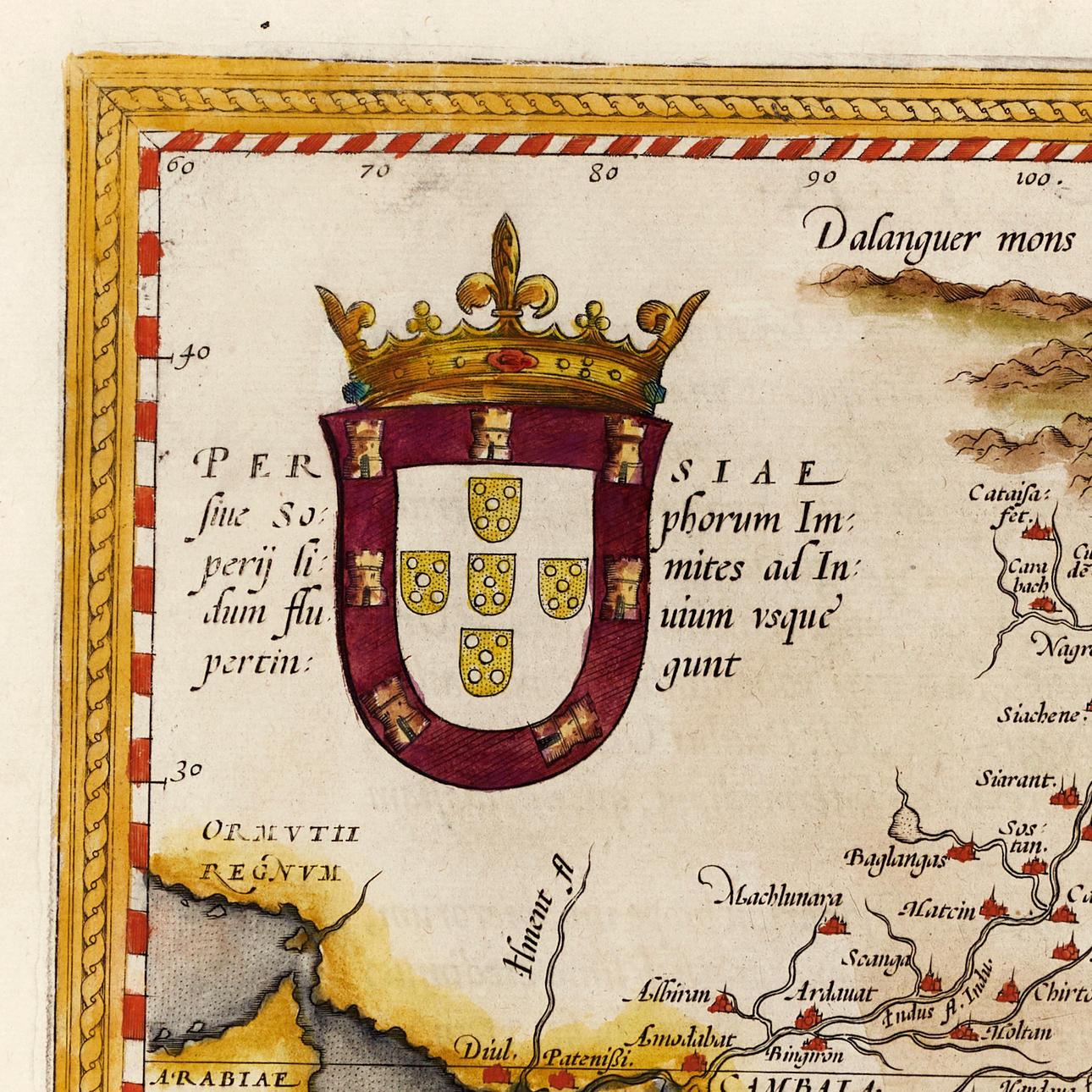
Slightly yellowed. Light spots and other minor defects in the margin. Rips in the margin with old repairs. A repaired tear in the lower margin reaching the image surface (approx. 65mm). The middle fold with some small holes and defects reinforced on verso.
Theme
Francesco Bacoccoli Collection - The Golden Era of Cartography: Part I
Do you have something similar to sell? Get your items valued free of charge!
Description
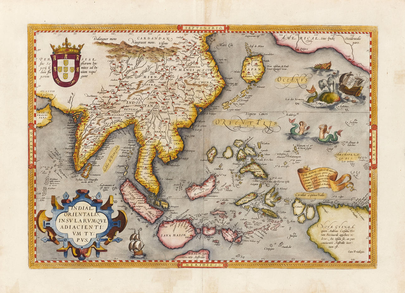
Abraham Ortelius, “Indiae Orientalis, Insularumque Adiacentium Typus”, engraved and hand-coloured map of East Asia and surrounding islands, 1573, from Ortelius' “Theatrum Orbis Terrarum”. Latin edition 1573 (1573L (A) 63, 40 copies).
Plate: 34.8 x 49.7 cm.
Leaf: 42,2 x 58,2 cm (watermark “Crossed arrows”).
LITERATURE: Van den Broecke, City 166.
Koeman/Meurer 48.
Great difficulties in mapping this island group caused maps of this area to remain inaccurate for the next centuries. Sumatra and Java appear excessively large and the Philippines is not fully extirpated where the northern island of Luzon is missing.
The seagulls on the right of the map are based on those reproduced on Diego Gutiérrez's map of the Americas (Cock, 1562).
Abraham Ortelius (1527-1598) was born in Antwerp and came to study Greek and Latin as well as mathematics. Together with his sisters Anne and Elisabeth, he colourised maps, but also traded in antiques, coins, books and maps. His business grew and so did his network of contacts with the scientists and book publishers of the time, which was also facilitated by the many trips he undertook in Europe.
In 1564, he published his first map, a map of the world that has survived only in a handful of copies. 1565 saw a map of Egypt and the Holy Land, as well as a map of Asia. In 1568 the production of individual maps for his atlas “Theatrum Orbis Terrarum” was in full swing and the following year, 1569 the atlas was completed. In May 1570 it was put up for sale to squatted speculators and was one of the costliest books ever published. The first edition consisted of 70 maps printed on 53 leaf sheets, and engraved by Frans Hogenberg. It became in great demand and some 24 editions were published during Ortelius' lifetime, and then another 10 editions in six different languages until 1612, the atlas also grew in the number of maps and pages after which new editions were published. The importance of Ortelius's atlas for the late 16th century understanding of the world and geographical knowledge cannot be emphasized enough. Today, Ortelius's atlas is often spoken of when referring to the “Theatrum Orbis Terrarum”, the term atlas itself, however, was first introduced over 20 years later by Mercator, but Ortelius was the one who, in the truest sense, created the first modern atlas.
Condition
Slightly yellowed. Light spots and other minor defects in the margin. Rips in the margin with old repairs. A repaired tear in the lower margin reaching the image surface (approx. 65mm). The middle fold with some small holes and defects reinforced on verso.
Theme
Francesco Bacoccoli Collection - The Golden Era of Cartography: Part I
Do you have something similar to sell? Get your items valued free of charge!