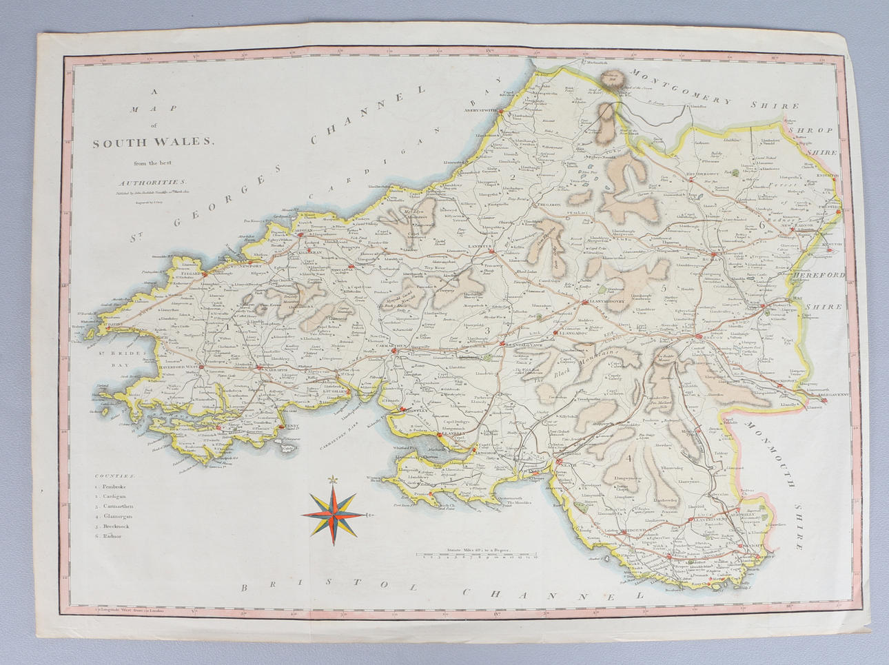
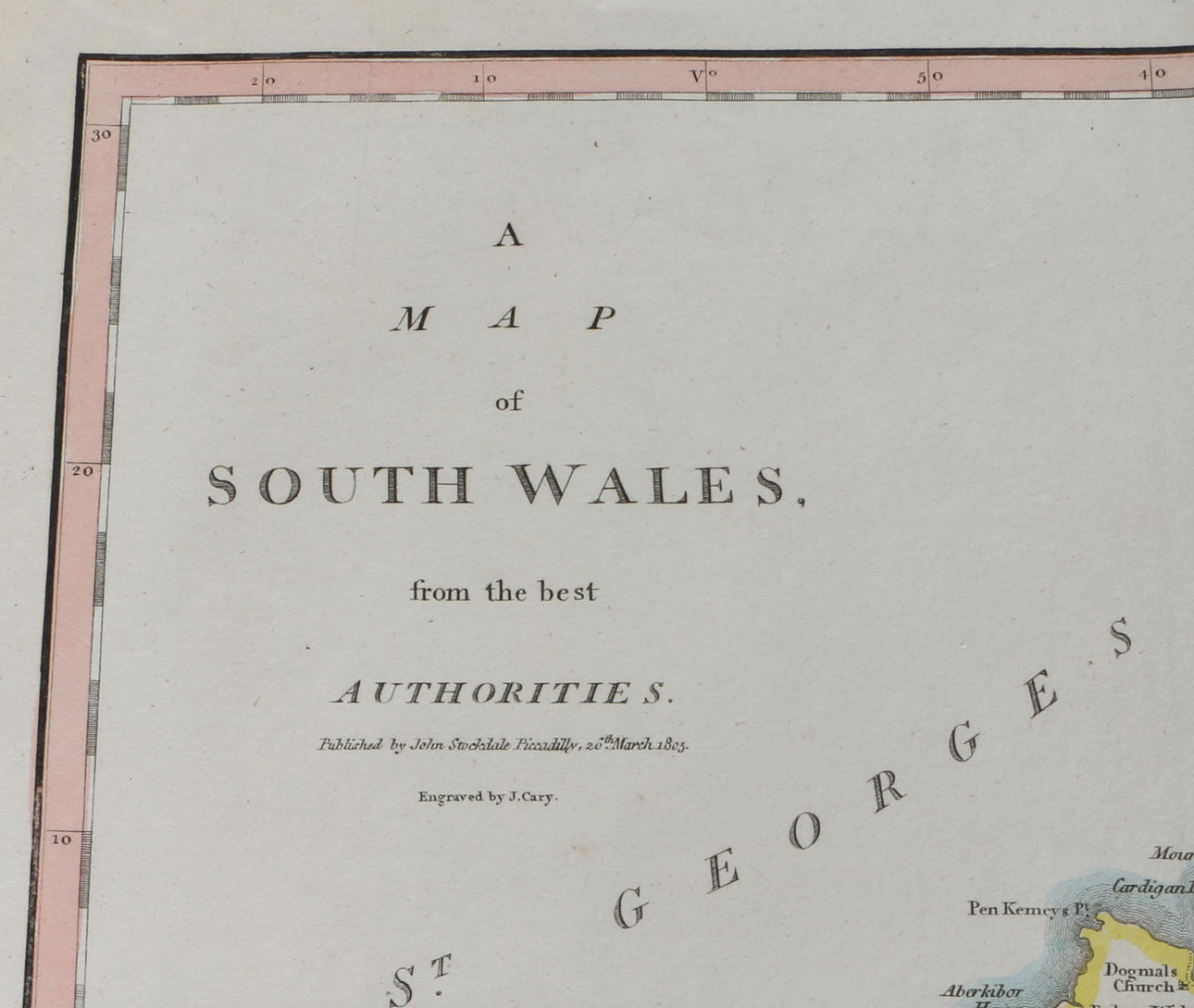
1805 ENGRAVED MAP OF SOUTH WALES BY J. CARY, PUBLISHED BY JOHN STOCKDALE.
4394599. 1805 ENGRAVED MAP OF SOUTH WALES BY J. CARY, PUBLISHED BY JOHN STOCKDALE.
Images
4394599. 1805 ENGRAVED MAP OF SOUTH WALES BY J. CARY, PUBLISHED BY JOHN STOCKDALE.
Description
an early 19th-century map titled "A Map of South Wales from the best Authorities," published by John Stockdale of Piccadilly, London, on 26th March 1805, and engraved by J. Cary, 42cm x 53cm (unframed).
Condition
A couple of fold lines running through the map, general fading and wear throughout.